IMAGES TAKEN NEAR TO
Desenfans Road, LONDON, SE21 7DN
Introduction
This page details the photographs taken nearby to Desenfans Road, SE21 7DN by members of the Geograph project.
The Geograph project started in 2005 with the aim of publishing, organising and preserving representative images for every square kilometre of Great Britain, Ireland and the Isle of Man.

There are currently over 7.5m images from over14,400 individuals and you can help contribute to the project by visiting https://www.geograph.org.uk
Image Map
Images are licensed for reuse under creativecommons.org/licenses/by-sa/2.0
Notes
- Clicking on the map will re-center to the selected point.
- The higher the marker number, the further away the image location is from the centre of the postcode.
Image Listing (146 Images Found)
Images are licensed for reuse under creativecommons.org/licenses/by-sa/2.0
Image
Details
Distance
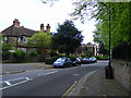
1
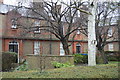
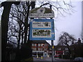
Desenfans Road Dulwich
Taken from Court Lane
Image: © PAUL FARMER
Taken: 25 Apr 2009
0.04 miles
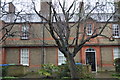
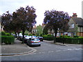
2
Court Lane Dulwich Village
Round here this street is approaching downmarket!
Image: © Glyn Baker
Taken: 8 Feb 2018
0.06 miles
4
Dekker Road Dulwich
At junction with Court Lane
Image: © PAUL FARMER
Taken: 25 Apr 2009
0.07 miles
6
Dulwich Churchyard
The churchyard in the centre of Dulwich Village. No church nearby so not sure which one it's attached to
Image: © Herry Lawford
Taken: 16 Mar 2007
0.07 miles
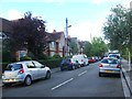
7
Pre-Worboys direction sign, Court Lane Dulwich Village
Image: © David Howard
Taken: 25 Jan 2009
0.07 miles
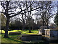
8
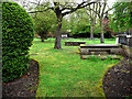
Dulwich Old Burial Ground
The small ground was created by Edward Alleyn as part of the foundation of his College of God's Gift. Thirty five Dulwich victims of the plague were buried in unmarked graves in the ground. Old Bridget, queen of the Norwood Gypsies (who appeared in the writings of Samuel Pepys) was also buried here in 1768. The ground was declared "full" in 1858, however the family of Louisa Shroeder obtained special permission for her remains to be interred in 1868. The ground's wrought iron gates and twelve tombs are Grade II listed.
from Wikipedia (trust it or not).
Image: © Chris Gunns
Taken: 11 Apr 2009
0.08 miles