IMAGES TAKEN NEAR TO
Dekker Road, LONDON, SE21 7DL
Introduction
This page details the photographs taken nearby to Dekker Road, SE21 7DL by members of the Geograph project.
The Geograph project started in 2005 with the aim of publishing, organising and preserving representative images for every square kilometre of Great Britain, Ireland and the Isle of Man.

There are currently over 7.5m images from over14,400 individuals and you can help contribute to the project by visiting https://www.geograph.org.uk
Image Map
Images are licensed for reuse under creativecommons.org/licenses/by-sa/2.0
Notes
- Clicking on the map will re-center to the selected point.
- The higher the marker number, the further away the image location is from the centre of the postcode.
Image Listing (144 Images Found)
Images are licensed for reuse under creativecommons.org/licenses/by-sa/2.0
Image
Details
Distance
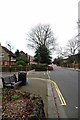
1
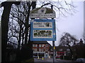
Pre-Worboys direction sign, Court Lane Dulwich Village
Image: © David Howard
Taken: 25 Jan 2009
0.03 miles
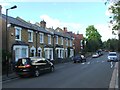
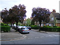
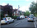
2
Court Lane Dulwich Village
Round here this street is approaching downmarket!
Image: © Glyn Baker
Taken: 8 Feb 2018
0.03 miles
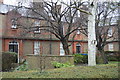
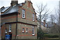
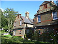
5
Dekker Road Dulwich
At junction with Court Lane
Image: © PAUL FARMER
Taken: 25 Apr 2009
0.03 miles
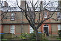
7
Victorian housing in Calton Avenue
Should there be any doubt exactly when this attractive group of houses were built, the dates of 1878 and 1879 are clearly picked out on the brickwork.
Image: © Marathon
Taken: 14 Sep 2011
0.04 miles