1
Railway bridge, Village Way, SE21
This bridge takes the railway between North Dulwich and Tulse Hill across Village Way. The sign prohibits vehicles higher than 14'3" from passing underneath.
Image: © Malc McDonald
Taken: 17 Oct 2010
0.04 miles
2
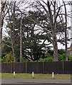
Cedar, Village Way
In the gardens of Pond House
Image
Image: © Stephen Richards
Taken: 6 Apr 2012
0.04 miles
3
Pond House, North Dulwich
Grade II listed house on Village Way.
See http://www.britishlistedbuildings.co.uk/en-471446-pond-house-and-handrails-to-steps-20-cam for more details about the building.
Image: © David Anstiss
Taken: 2 Oct 2011
0.05 miles
4
Pond House, Village Way
A grand composition, even if not large. The centre has a canted bay, Venetian window and pediment. The main block is mid C18th, the lower wing early C19th. Grade II listed.
Image: © Stephen Richards
Taken: 6 Apr 2012
0.06 miles
5
Railway bridge over Village Way
Village Way leads from East Dulwich towards Herne Hill.
The railway bridge carries the line from Tulse Hill towards North Dulwich.
Image: © David Anstiss
Taken: 2 Oct 2011
0.06 miles
6
Railway south of North Dulwich station
Section BTH1 - South Bermondsey Junction to Sutton (East) Junction.
Image: © Robin Webster
Taken: 23 Jul 2011
0.06 miles
7
Village Way railway bridge
This bridge was rebuilt earlier this year (2014). New deck beams were installed, and the cast iron support columns (in line with the kerbs) were removed. Compare with
Image
Image: © Ian Taylor
Taken: 20 Sep 2014
0.07 miles
8
Pond Mead, SE21
Pond Mead, a private housing development in Dulwich Village.
Image: © Malc McDonald
Taken: 17 Oct 2010
0.09 miles
9
Lydenhurst House, Dulwich
Grade II listed house on the junction of Red Post Hill (on the right) and East Dulwhich Grove (in front).
See http://www.britishlistedbuildings.co.uk/en-471445-lyndenhurst-house-19-camberwell for more details about the building.
Image: © David Anstiss
Taken: 2 Oct 2011
0.09 miles
10
'Onaway', 135 Half Moon Lane
Presumably this fine building was originally owned by a single family; it is now a block of flats. I am told it is not a listed building, but extensions are being made in a sensitive way that will fit in with the house.
Image: © Dr Neil Clifton
Taken: 18 Jul 2012
0.09 miles


