IMAGES TAKEN NEAR TO
Brodrick Grove, LONDON, SE2 0SS
Introduction
This page details the photographs taken nearby to Brodrick Grove, SE2 0SS by members of the Geograph project.
The Geograph project started in 2005 with the aim of publishing, organising and preserving representative images for every square kilometre of Great Britain, Ireland and the Isle of Man.

There are currently over 7.5m images from over14,400 individuals and you can help contribute to the project by visiting https://www.geograph.org.uk
Image Map
Images are licensed for reuse under creativecommons.org/licenses/by-sa/2.0
Notes
- Clicking on the map will re-center to the selected point.
- The higher the marker number, the further away the image location is from the centre of the postcode.
Image Listing (44 Images Found)
Images are licensed for reuse under creativecommons.org/licenses/by-sa/2.0
Image
Details
Distance
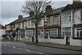
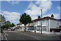
3
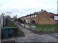
Caerleon Terrace, Abbey Wood
Housing on Caerleon Terrace in Abbey Wood, in the suburbs of south east London.
Image: © Malc McDonald
Taken: 30 Dec 2017
0.06 miles
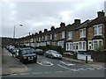
4
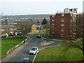
View from railway bridge, Abbey Wood
Bostall Wood is on the skyline.
Image: © Robin Webster
Taken: 14 Mar 2012
0.07 miles
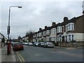
6
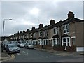
Housing Terrace, McLeod Road
By the crossing with Bostall Lane.
Image: © Des Blenkinsopp
Taken: 30 May 2023
0.07 miles
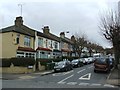
7
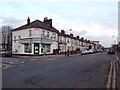
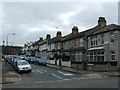
Abbey Wood Road, Abbey Wood
A local shop on the corner of Abbey Wood Road and Bostall Manorway, in the suburbs of south east London.
Image: © Malc McDonald
Taken: 30 Dec 2017
0.07 miles