IMAGES TAKEN NEAR TO
Myrtledene Road, LONDON, SE2 0EU
Introduction
This page details the photographs taken nearby to Myrtledene Road, SE2 0EU by members of the Geograph project.
The Geograph project started in 2005 with the aim of publishing, organising and preserving representative images for every square kilometre of Great Britain, Ireland and the Isle of Man.

There are currently over 7.5m images from over14,400 individuals and you can help contribute to the project by visiting https://www.geograph.org.uk
Image Map
Images are licensed for reuse under creativecommons.org/licenses/by-sa/2.0
Notes
- Clicking on the map will re-center to the selected point.
- The higher the marker number, the further away the image location is from the centre of the postcode.
Image Listing (32 Images Found)
Images are licensed for reuse under creativecommons.org/licenses/by-sa/2.0
Image
Details
Distance
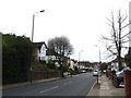
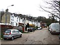
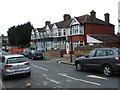
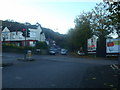
2
McLeod Road at the junction with Bostall Hill
Image: © David Howard
Taken: 11 Mar 2012
0.06 miles
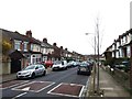
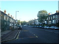
7
McLeod Road, Abbey Wood
At the crossroads with Basildon Road
Image: © David Howard
Taken: 11 Mar 2012
0.11 miles
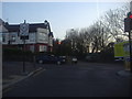
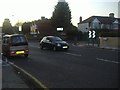
9
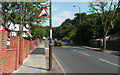
Bostall Hill - Steep Hill 10%
Bostall Hill, Abbey Wood. 10% steep hill up sign.
Image: © Adam Morse
Taken: 8 Aug 2009
0.12 miles