IMAGES TAKEN NEAR TO
Minden Road, LONDON, SE20 8EE
Introduction
This page details the photographs taken nearby to Minden Road, SE20 8EE by members of the Geograph project.
The Geograph project started in 2005 with the aim of publishing, organising and preserving representative images for every square kilometre of Great Britain, Ireland and the Isle of Man.

There are currently over 7.5m images from over14,400 individuals and you can help contribute to the project by visiting https://www.geograph.org.uk
Image Map
Images are licensed for reuse under creativecommons.org/licenses/by-sa/2.0
Notes
- Clicking on the map will re-center to the selected point.
- The higher the marker number, the further away the image location is from the centre of the postcode.
Image Listing (62 Images Found)
Images are licensed for reuse under creativecommons.org/licenses/by-sa/2.0
Image
Details
Distance
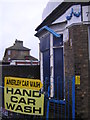
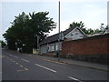
3
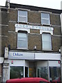
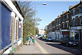
Anerley House, Anerley Station Road
The firm Victorian full stop brooks no argument.
Image: © Christopher Hilton
Taken: 23 Dec 2011
0.03 miles
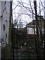
4
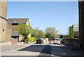
Panorama from Anerley Hill #2
Looking north-northeast into Minden Road.
Image: © Robert Lamb
Taken: 14 Jul 2011
0.03 miles
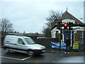
5
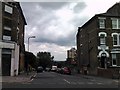
Anerley station
Access to Anerley station is now through a modern building down Anerley Station Road (which runs downhill off the right side of this photograph) but when it was built originally it appears that access was via separate stairs down to each platform with a little lodge at the head of each one. The little building in the foreground is above the down, southbound platform and a corresponding one is on the other side of the bridge, in the middle distance. Similar layouts were used at Penge West and Sydenham, up the line towards London; neither now survives.
Image: © Christopher Hilton
Taken: 23 Dec 2011
0.04 miles
6
Anerley station
Access to Anerley station is now through a modern building down Anerley Station Road (which runs downhill off the right side of this photograph) but when it was built originally it appears that access was via separate stairs down to each platform with a little lodge at the head of each one. The little building in the left foreground is above the down, southbound platform and a corresponding one is on the other side of the bridge, in the middle distance. Similar layouts were used at Penge West and Sydenham, up the line towards London; neither now survives.
Image: © Christopher Hilton
Taken: 23 Dec 2011
0.04 miles
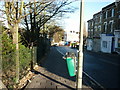
7
Anerley station
Access to Anerley station is now through a modern building down Anerley Station Road (which leaves the main road just off the right side of this photograph, and runs downhill alongside the railway in the same direction that the camera is pointing) but when it was built originally it appears that access was via separate stairs down to each platform with a little lodge at the head of each one. The little building behind the lights is above the down, southbound platform and a corresponding one is on the other side of the bridge, off the left of the photograph. Similar layouts were used at Penge West and Sydenham, up the line towards London; neither now survives.
Image: © Christopher Hilton
Taken: 23 Dec 2011
0.04 miles
10
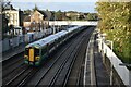
Train passing through Anerley Station
Image: © David Martin
Taken: 30 Oct 2022
0.05 miles