IMAGES TAKEN NEAR TO
Broadwall, LONDON, SE1 9PS

Introduction

This page details the photographs taken nearby to Broadwall, SE1 9PS by members of the Geograph project.

The Geograph project started in 2005 with the aim of publishing, organising and preserving representative images for every square kilometre of Great Britain, Ireland and the Isle of Man.

There are currently over 7.5m images from over14,400 individuals and you can help contribute to the project by visiting https://www.geograph.org.uk

Image Map


Images are licensed for reuse under creativecommons.org/licenses/by-sa/2.0
Notes
  • Clicking on the map will re-center to the selected point.
  • The higher the marker number, the further away the image location is from the centre of the postcode.

Image Listing (1447 Images Found)

Images are licensed for reuse under creativecommons.org/licenses/by-sa/2.0
  • ...
Image
Details
Distance
1
The Fountain & Ink
Image: © N Chadwick Taken: 27 Feb 2022
0.02 miles
2
The Thirsty Bear, Southwark
Image: © Chris Whippet Taken: 9 Feb 2014
0.02 miles
3
Bernie Spain Gardens
A public park lying between Stamford Street and the river.
Image: © Patrick Mackie Taken: 19 May 2010
0.02 miles
4
Stamford St
Image: © N Chadwick Taken: 27 Feb 2022
0.02 miles
5
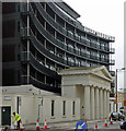
57 Stamford Street, SE1
Portico of a former Unitarian chapel, otherwise demolished. The grade II listed remains now serve as an entrance to the building beyond.
Image: © Robin Webster Taken: 14 Mar 2009
0.02 miles
6
Former portico, Stamford Street
This stately Greek Doric portico is the only remnant of the Stamford Street Unitarian Chapel, built in 1823 and demolished in 1964. Grade II listed. It now heralds a modern block of flats. The man on the left, one of a crew resurfacing the road, was getting very tetchy with motorists approaching from the left who wanted him to move his bollards.
Image: © Stephen Richards Taken: 2 Apr 2011
0.03 miles
7
Low trees in Broadwall
To my untrained eye, I see nothing unusual. These trees appear to reach the ground like any other. I think TfL might mean "low branches", but I can't be certain. However, this road is used by buses, so I presume the warning is for them.
Image: © Patrick Mackie Taken: 27 Mar 2012
0.03 miles
8
Kings Reach, Stamford Street (2)
Looking up the tower. Wider view and more info here: Image
Image: © Stephen Richards Taken: 14 Aug 2011
0.03 miles
9
London Nautical School
View from Bernie Spain Gardens.
Image: © Patrick Mackie Taken: 19 May 2010
0.04 miles
10
London Nautical School, Stamford Street, SE1
A grade II listed building, early 19th century, increased in height some years later.
Image: © Robin Webster Taken: 14 Mar 2009
0.04 miles
  • ...