57 Stamford Street, SE1
Introduction
The photograph on this page of 57 Stamford Street, SE1 by Robin Webster as part of the Geograph project.
The Geograph project started in 2005 with the aim of publishing, organising and preserving representative images for every square kilometre of Great Britain, Ireland and the Isle of Man.

There are currently over 7.5m images from over 14,400 individuals and you can help contribute to the project by visiting https://www.geograph.org.uk
57 Stamford Street, SE1
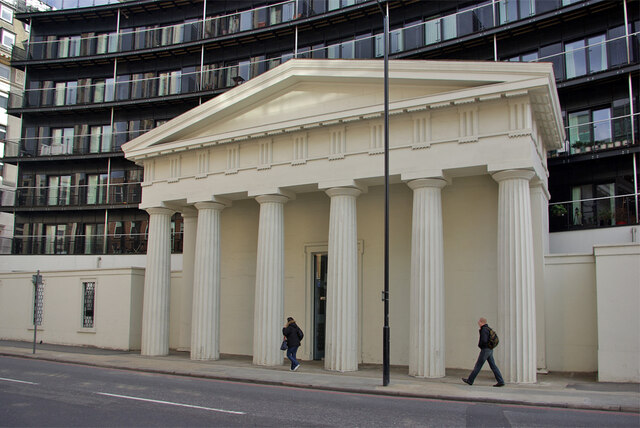
Image: © Robin Webster Taken: 14 Mar 2009
Portico of a former Unitarian chapel, otherwise demolished. The grade II listed remains now serve as an entrance to the building beyond.
Images are licensed for reuse under creativecommons.org/licenses/by-sa/2.0
Image Location
Latitude
51.506898
Longitude
-0.107773