IMAGES TAKEN NEAR TO
Beaumont Road, LONDON, SE19 3QZ
Introduction
This page details the photographs taken nearby to Beaumont Road, SE19 3QZ by members of the Geograph project.
The Geograph project started in 2005 with the aim of publishing, organising and preserving representative images for every square kilometre of Great Britain, Ireland and the Isle of Man.

There are currently over 7.5m images from over14,400 individuals and you can help contribute to the project by visiting https://www.geograph.org.uk
Image Map
Images are licensed for reuse under creativecommons.org/licenses/by-sa/2.0
Notes
- Clicking on the map will re-center to the selected point.
- The higher the marker number, the further away the image location is from the centre of the postcode.
Image Listing (76 Images Found)
Images are licensed for reuse under creativecommons.org/licenses/by-sa/2.0
Image
Details
Distance
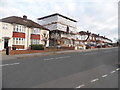
1
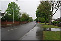
Beulah Hill (A215)
The route of the Capital Ring.
Image: © N Chadwick
Taken: 8 May 2010
0.05 miles
2
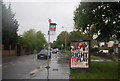
Bus stop, Beulah Hill (A215)
The route of the Capital Ring.
Image: © N Chadwick
Taken: 8 May 2010
0.06 miles
6
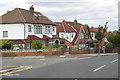
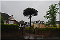
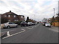
Convent Hill, Upper Norwood
The name Norwood covers an extensive area of south London suburbia - normally divided into West Norwood, Upper Norwood and South Norwood; it derives from the Great North Wood that covered the district before it was built up in the 19th and 20th centuries. Classic London inter-war semi-detached houses are common including these seen here on Convent Hill at the junction with Beaumont Road. As the name implies it is on a hill, sloping down from Beulah Hill towards Convent Wood which takes its name from the Catholic Convent and Church of Virgo Fidelis built in 1842.
Image: © Stephen McKay
Taken: 6 Sep 2018
0.08 miles
8
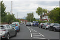
Convent Hill, Upper Norwood
Convent Hill leads down from Beulah Hill to Convent Wood. A number of tall central London buildings can be seen in the distance including the Shard.
Image: © Stephen McKay
Taken: 6 Sep 2018
0.09 miles
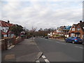
10
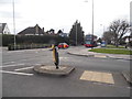
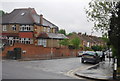
Convent Hill at the junction of Beulah Hill
Image: © David Howard
Taken: 5 Apr 2015
0.10 miles