IMAGES TAKEN NEAR TO
Patterson Road, LONDON, SE19 2LG
Introduction
This page details the photographs taken nearby to Patterson Road, SE19 2LG by members of the Geograph project.
The Geograph project started in 2005 with the aim of publishing, organising and preserving representative images for every square kilometre of Great Britain, Ireland and the Isle of Man.

There are currently over 7.5m images from over14,400 individuals and you can help contribute to the project by visiting https://www.geograph.org.uk
Image Map
Images are licensed for reuse under creativecommons.org/licenses/by-sa/2.0
Notes
- Clicking on the map will re-center to the selected point.
- The higher the marker number, the further away the image location is from the centre of the postcode.
Image Listing (478 Images Found)
Images are licensed for reuse under creativecommons.org/licenses/by-sa/2.0
Image
Details
Distance
1
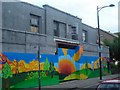
Upper Norwood: car showroom, closed
This car showroom dates, from the look of it, from between the wars, and closed early in the 21st century. At time of writing (early 2011) it has been boarded up like this for some years, with no immediate plans for its future.
Image: © Christopher Hilton
Taken: 28 Jun 2008
0.03 miles
2
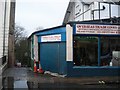
Upper Norwood: Overseas Trade Links, Church Road
This firm specialised in agricultural machinery for developing countries and as a result Upper Norwood would sometimes have the unusual experience, for a London suburb, of having a classic 1970s Massey Ferguson tractor rumbling around it. At time of writing (early 2011) the premises are being emptied.
Image: © Christopher Hilton
Taken: 21 Mar 2008
0.04 miles
3
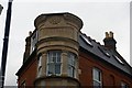
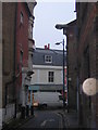
St Aubyn's Parade, Church Road
At the junction of Church Road and Stoney Lane, the latter one of the little lanes that lead into the middle of the Crystal Palace Triangle.
Image: © Christopher Hilton
Taken: 10 Sep 2008
0.05 miles
4
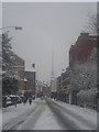
North on A212 Church Road, Crystal Palace
A street of several uses characteristically choked and deafening with traffic.
Image: © Robin Stott
Taken: 16 May 2022
0.05 miles
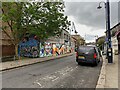
7
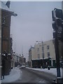
Crossing, A212 Church Road, Crystal Palace
Church Road is much more mixed in usage than the other two sides of the Crystal Palace 'triangle'. Always busy with traffic, as though everyone stays indoors.
Image: © Robin Stott
Taken: 16 May 2022
0.05 miles
8
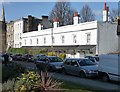
Almshouses, Belvedere Road
A pretty little row of stuccoed houses with a continuous cast iron verandah. The listed building description dates them as c1850. Grade II listed.
The spire peeping up on the left belongs to the Greek Orthodox church on Westow Street.
Image: © Stephen Richards
Taken: Unknown
0.05 miles
9
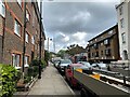
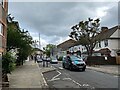
Stoney Lane, looking out of the Norwood triangle
The centre of the Upper Norwood triangle used to be given over to light industry: joinery, engineering and so forth. Some works survive, but much of it now is made up of small housing estates, various cul-de-sac lanes into the triangle giving onto a network of pedestrian paths. Stoney Lane leads in from the south. A dark afternoon, hence the flash was used and picked out something close to the camera on the right side of the shot: I'm not sure what it is.
Image: © Christopher Hilton
Taken: 30 Dec 2010
0.06 miles
10
Dereliction on A212 Church Road, Crystal Palace
Image: © Robin Stott
Taken: 16 May 2022
0.06 miles