1
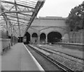
Anerley Vale
Image: © N Chadwick
Taken: 9 Apr 2011
0.02 miles
2
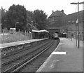
Crystal Palace station
View north or north west from Platform 2
Image: © Martin Bodman
Taken: 1 Sep 2001
0.02 miles
3
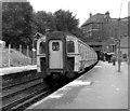
Crystal Palace (Low Level) Station, (North side)
The West End of London and Crystal Palace railway was one of the earlier lines in South London, its objective being to cash in on the large number of visitors expected to the Crystal Palace following it's removal from Hyde Park after the 1851 Great Exhibition. This attraction was rebuilt 1852-1854 with significant enlargement, but burnt down in 1936. The original terminus was here, opening in 1854, and was laid out spaciously in anticipation of heavy traffic. Now in 2007 as in 1979, this side of the station sees very little use.
Image: © Dr Neil Clifton
Taken: 19 Jul 1979
0.02 miles
4
Crystal Palace (Low Level) station, South side
This side of the station was a later addition to the original
Image and now is by far the busier part of the station. A 4-EPB unit destined for Coulsdon North is seen entering the Platform 2.
Image: © Dr Neil Clifton
Taken: 19 Jul 1979
0.02 miles
5
Crystal Palace (Low Level) station
Image: © Dr Neil Clifton
Taken: 28 Jul 1972
0.02 miles
6
Crystal Palace (LL) station
A '2-EPB' unit, No 5658, runs into Crystal Palace station, heading an Up service from Coulsdon North to Victoria.
Image: © Dr Neil Clifton
Taken: 19 Jul 1979
0.02 miles
7
Crystal Palace (LL) station
'4-CIG' unit No 7374 runs into the Down platform at Crystal Palace. These express units did not normally serve this station. (The 'CIG' in the name of the unit does not mean it had extra accommodation for smokers).
Image: © Dr Neil Clifton
Taken: 19 Jul 1979
0.02 miles
8
Crystal Palace (LL) station
At Platform 1, a train is just leaving for all stations to London Bridge. It has come from Beckenham Junction. It is Unit No 377 143 and will run via Tulse Hill. It is also possible to get to London Bridge by trains travelling in the opposite direction, from Platform 4: these latter operate via Forest Hill.
Image: © Dr Neil Clifton
Taken: 9 Mar 2010
0.02 miles
9
Crystal Palace (LL) station
Platforms 1 and 2. In front of the camera, the lines lead northwest and either London Bridge or Victoria is accessible. Behind, the lines lead from Beckenham Junction and Bromley, with also a flyover from Norwood Junction and Croydon.
Image: © Dr Neil Clifton
Taken: 9 Mar 2010
0.02 miles
10
Crystal Palace (LL) station
A Down train, comprised of unit No 455 831, is leaving from Platform 2. Its probable destination is West Croydon.
Image: © Dr Neil Clifton
Taken: 9 Mar 2010
0.02 miles


