IMAGES TAKEN NEAR TO
Highland Road, LONDON, SE19 1DS
Introduction
This page details the photographs taken nearby to Highland Road, SE19 1DS by members of the Geograph project.
The Geograph project started in 2005 with the aim of publishing, organising and preserving representative images for every square kilometre of Great Britain, Ireland and the Isle of Man.

There are currently over 7.5m images from over14,400 individuals and you can help contribute to the project by visiting https://www.geograph.org.uk
Image Map
Images are licensed for reuse under creativecommons.org/licenses/by-sa/2.0
Notes
- Clicking on the map will re-center to the selected point.
- The higher the marker number, the further away the image location is from the centre of the postcode.
Image Listing (272 Images Found)
Images are licensed for reuse under creativecommons.org/licenses/by-sa/2.0
Image
Details
Distance
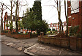
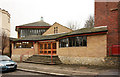
2
Summit of Lunham Road and the junction with Vicar's Oak Road, Norwood
Image: © Robin Stott
Taken: 19 May 2022
0.04 miles
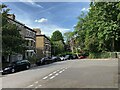
10
Pedestrian crossing, Gipsy Hill, Norwood
Image: © Robin Stott
Taken: 14 May 2022
0.06 miles