IMAGES TAKEN NEAR TO
Nightingale Vale, LONDON, SE18 4EH
Introduction
This page details the photographs taken nearby to Nightingale Vale, SE18 4EH by members of the Geograph project.
The Geograph project started in 2005 with the aim of publishing, organising and preserving representative images for every square kilometre of Great Britain, Ireland and the Isle of Man.

There are currently over 7.5m images from over14,400 individuals and you can help contribute to the project by visiting https://www.geograph.org.uk
Image Map
Images are licensed for reuse under creativecommons.org/licenses/by-sa/2.0
Notes
- Clicking on the map will re-center to the selected point.
- The higher the marker number, the further away the image location is from the centre of the postcode.
Image Listing (66 Images Found)
Images are licensed for reuse under creativecommons.org/licenses/by-sa/2.0
Image
Details
Distance
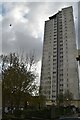
2
Flats on the corner of Woolwich Common and Nightingale Place
Image: © David Howard
Taken: 23 Feb 2014
0.09 miles
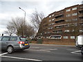
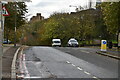
4
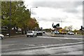
A205 South Circular Road, Woolwich
To get to the North Circular Road by the shortest route from here, it is necessary to take the Woolwich Free Ferry.
Image: © Robin Webster
Taken: 14 Mar 2012
0.10 miles
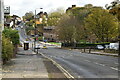
5
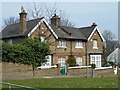
Houses on Nightingale Place, Woolwich
These seem to have once been part of the War Department property here.
Image: © Robin Webster
Taken: 14 Mar 2012
0.11 miles
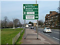
6
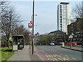
Bus stop S, Nightingale Place, Woolwich
Named Woolwich Common, and served by route 244 towards Shooters Hill.
Image: © Robin Webster
Taken: 14 Mar 2012
0.11 miles
8
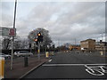
Woolwich Common at the junction of Ha Ha Road
Please let me know if you can see anything funny in this picture, I am not able to myself.
Image: © David Howard
Taken: 23 Feb 2014
0.11 miles
10
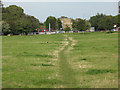
Woolwich Common: footpath towards the town
This unofficial footpath across the common has probably been formed by people walking between Woolwich town centre and the Queen Elizabeth Hospital (behind the photographer)
Image: © Stephen Craven
Taken: 20 Sep 2008
0.12 miles