1
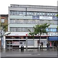
Vans in Manor Place depot
Taken to complement the ground-level views taken earlier in the week. The railway viaduct offers the only vantage point for this part of the site.
Image: © Stephen Craven
Taken: 2 May 2015
0.01 miles
2
Former council offices, 34 Penrose Street, Walworth
These offices are now closed pending redevelopment (see shared description below). See the two plaques
Image and
Image for something of the history of the site.
Image: © Stephen Craven
Taken: 29 Apr 2015
0.02 miles
3
Entrance to former council offices, Penrose Street
Detail of the former Southwark Council Environment and Leisure Department offices
Image showing the location of the plaques.
Image: © Stephen Craven
Taken: 29 Apr 2015
0.02 miles
4
1898 plaque, former council offices, Penrose Street
The plaque on the former office building
Image records the building of the previous building on the site, which was an electricity generating station.
Image: © Stephen Craven
Taken: 29 Apr 2015
0.02 miles
5
1945 plaque, former council offices, Penrose Street
The plaque on the former office building
Image records its construction on the site after the Second World War, in which the electricity generating station that formerly stood on the site was destroyed. See also
Image
Image: © Stephen Craven
Taken: 29 Apr 2015
0.02 miles
6
Railway Bridge over Penrose Street
Penrose Street heads to Walworth Road. The railway heads left towards Elephant and Castle Station.
Image: © David Anstiss
Taken: 27 Nov 2009
0.03 miles
7
Former council depot entrance, Penrose Street, Walworth
One of the several entrances to the council site, now closed pending redevelopment. The Strata Tower is visible in the distance.
Image: © Stephen Craven
Taken: 29 Apr 2015
0.03 miles
8
Walworth Post Office, Walworth Road, London
Image: © Robin Stott
Taken: 21 Sep 2015
0.03 miles
9
Shopfront, 305 Walworth Road, Walworth, London
Kennedy's was a chain of grocer's or butcher's shops. My wife's mother, when the family lived in West Wickham, always bought at Kennedy's. After her death, no matter at whose home we 'children' were meeting up for Christmas, a family member would make the journey to Wickham for Kennedy's pork chipolata sausages to accompany the roast bird.
This shopfront has some endearing features: the 'sunrise' motif in the upper panes of glass; polished granite, possibly, below the window; and a prettily tiled threshold. The first two items hint at a 1920s or 30s makeover, while the tiles and fascia date from an earlier period. This business is some form of eatery.
Image: © Robin Stott
Taken: 21 Sep 2015
0.04 miles
10
Shops, Walworth Road
On our way to Christmas lunch via Camberwell Green we took a wrong turning after Elephant & Castle but found our way through side streets to the Walworth Road here, opposite BUY N BUY, a general foodstore open for business on Christmas Day. We noticed a few such shops open on our way through south London. Photographed at 11:59:39. Weather relatively mild for late December, cloudy with brief sunny breaks, damp.
Image: © Robin Stott
Taken: 25 Dec 2011
0.04 miles


