IMAGES TAKEN NEAR TO
Albion Street, LONDON, SE16 7LN
Introduction
This page details the photographs taken nearby to Albion Street, SE16 7LN by members of the Geograph project.
The Geograph project started in 2005 with the aim of publishing, organising and preserving representative images for every square kilometre of Great Britain, Ireland and the Isle of Man.

There are currently over 7.5m images from over14,400 individuals and you can help contribute to the project by visiting https://www.geograph.org.uk
Image Map
Images are licensed for reuse under creativecommons.org/licenses/by-sa/2.0
Notes
- Clicking on the map will re-center to the selected point.
- The higher the marker number, the further away the image location is from the centre of the postcode.
Image Listing (649 Images Found)
Images are licensed for reuse under creativecommons.org/licenses/by-sa/2.0
Image
Details
Distance

2
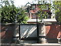
The 'Adam and Eve', Rotherhithe
This is a peaceful London pub in the village-like atmosphere of Rotherhithe. The pub. sign, sadly defaced on one side, depicts Adam and Eve standing naked, (although provided with decent, if oversized, fig leaves), one each side of the Tree of Knowledge, round which coils the evil serpent, ready to lead them astray. I expect they enjoyed it!
Image: © Dr Neil Clifton
Taken: 13 Sep 2007
0.01 miles
3
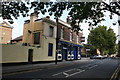
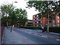
Brunel Road
Brunel Road in Rotherhithe.
Image: © Peter McDermott
Taken: 6 Dec 2015
0.01 miles
4

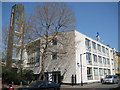
Interior of the Finnish Church in Rotherhithe
The church on Albion Street, dating from 1956-58, is listed grade 2 (list entry number 1376608) as an unusual example of a concrete-built church. It was open to the public for Open House Weekend but I did not get to see the basement sauna.
Image: © Stephen Craven
Taken: 20 Sep 2014
0.01 miles
5
Coopers Arms pub (site of) Brunel Road, Rotherhithe, London, SE16
A pub of very short duration lasting from 1832 to 1867 standing opposite the junction with Hatteraick Street and the Bricklayers Arms pub. It was bought out by the East London Railways when they wanted to extend the proposed railway in the Thames Tunnel. Immediately behind the wall is the approach road to Rotherhithe Tunnel. To the left of this wall are the stairs to the approach road. Photographer standing in Hatteraick Street and on the right is the ex Bricklayers Arms pub that is now a Chinese restaurant.
Image: © Chris Lordan
Taken: 11 Dec 2009
0.01 miles
6
Archway at the top of the tunnel steps
For the steps down to the left beyond this archway on Brunel Road, see Image
Image: © Stephen Craven
Taken: 22 May 2010
0.01 miles
7
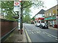
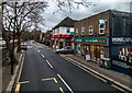
Brunel Road, SE16
Over the wall on the left is the entrance to the Rotherhithe Tunnel.
Image: © Phillip Perry
Taken: 13 Jul 2008
0.02 miles
8
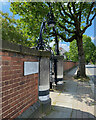
Gate to the tunnel, Rotherhithe
Across Brunel Road from Rotherhithe Overground station is an elegant wrought-iron gate leading directly to steps down to a footway through the Rotherhithe road tunnel Image The corresponding access on the east side is closed Image
Photo number 7784301.
Image: © Robin Stott
Taken: 25 May 2024
0.02 miles
9
Rotherhithe: Lontoon Suomalainen Kirkko...
... or the Finnish Church in London.
The church was completed in 1958 as the Finnish Seamen's Mission to cater for Finnish seamen in ships using the nearby docks, but now serves the broader Finnish community in London. The building was designed by Cyril Mardall of Yorke, Rosenberg and Mardall and is clad in Portland stone. The church, its six stage tower to the left, and its unusual interior arrangements are now Grade II listed.
For a view of the tower from the north-west side please see Stephen's Image
The Church's website is here http://www.finnishchurch.org.uk/
Image: © Nigel Cox
Taken: 18 Apr 2010
0.02 miles