IMAGES TAKEN NEAR TO
Fir Trees Close, LONDON, SE16 5NG
Introduction
This page details the photographs taken nearby to Fir Trees Close, SE16 5NG by members of the Geograph project.
The Geograph project started in 2005 with the aim of publishing, organising and preserving representative images for every square kilometre of Great Britain, Ireland and the Isle of Man.

There are currently over 7.5m images from over14,400 individuals and you can help contribute to the project by visiting https://www.geograph.org.uk
Image Map
Images are licensed for reuse under creativecommons.org/licenses/by-sa/2.0
Notes
- Clicking on the map will re-center to the selected point.
- The higher the marker number, the further away the image location is from the centre of the postcode.
Image Listing (283 Images Found)
Images are licensed for reuse under creativecommons.org/licenses/by-sa/2.0
Image
Details
Distance
1
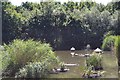
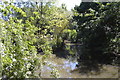
Turf Zone "Salterside"
Nelson Walk at Salter Road, Rotherhithe, London.
Image: © Ian S
Taken: 24 Dec 2022
0.04 miles
8
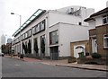
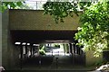
Noah's Ark pub (site of) 380 Rotherhithe Street, London SE16
It was about 150 yards east of Beatson Walk and at the junction of a narrow alley called "Screw Post Row". This would make it about where the nearest corner of the white building now stands. It was a three-storey pub, first recorded in 1805 and closed in 1933.
Image: © Chris Lordan
Taken: 19 Oct 2009
0.09 miles