IMAGES TAKEN NEAR TO
Brunel Road, LONDON, SE16 5GA
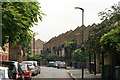
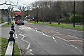
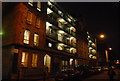
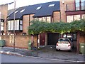
Introduction
This page details the photographs taken nearby to Brunel Road, SE16 5GA by members of the Geograph project.
The Geograph project started in 2005 with the aim of publishing, organising and preserving representative images for every square kilometre of Great Britain, Ireland and the Isle of Man.

There are currently over 7.5m images from over14,400 individuals and you can help contribute to the project by visiting https://www.geograph.org.uk
Image Map
Images are licensed for reuse under creativecommons.org/licenses/by-sa/2.0
Notes
- Clicking on the map will re-center to the selected point.
- The higher the marker number, the further away the image location is from the centre of the postcode.
Image Listing (434 Images Found)
Images are licensed for reuse under creativecommons.org/licenses/by-sa/2.0
Image
Details
Distance
1
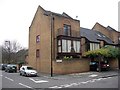
Rodneys Head pub (site of) 206, Rotherhithe Street, London, SE16
This stood at the west junction of Brunel Road from the mid 1700's to 1903. Previously named 'Admiral Rodney' and the 'Ship & Punch Bowl'. Site is now 218 Rotherhithe Street.
Image: © Chris Lordan
Taken: 24 Nov 2009
0.01 miles
2
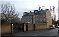
The Cottage pub (site of) Brunel Road, Rotherhithe, London, SE16
The pub stood in the east section of the road from 1859 until 1864. Built by an individual to cater for the large number of workmen in the area. However, it was bought out by the gas company who wanted to extend their premises. Image taken from close to the junction with Rotherhithe Street - building shown is 'Nelson Court'.
Image: © Chris Lordan
Taken: 9 Dec 2009
0.01 miles
3
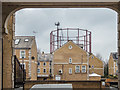
Gas Holder Rotherhithe, London SE1
As seen through the archway of one of the buildings along the Thames Path.
Image: © Christine Matthews
Taken: 10 Mar 2016
0.01 miles
4
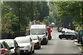
View along Swan Road from the Thames Path
Looking south-southeast.
Image: © Robert Lamb
Taken: 12 Jul 2014
0.02 miles
5
View along Rotherhithe Street
Looking north-northeast.
Image: © Robert Lamb
Taken: 12 Jul 2014
0.03 miles
8
Ship pub (site of) 194, Rotherhithe Street, London, SE16
This stood at the junction with Neston Street from about 1805 until 1961. Neston Street ceased to exist in the early 1960's and was blocked off until the construction of the buildings shown in the late 1980's. Numbers shown are 206 and 208.
Image: © Chris Lordan
Taken: 4 Nov 2009
0.04 miles
10
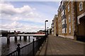
Cumberland Wharf in Rotherhithe
The Thames Path runs along Cumberland Wharf.
Image: © Steve Daniels
Taken: 25 Jun 2012
0.05 miles