IMAGES TAKEN NEAR TO
Lucey Way, LONDON, SE16 3UD
Introduction
This page details the photographs taken nearby to Lucey Way, SE16 3UD by members of the Geograph project.
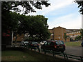
The Geograph project started in 2005 with the aim of publishing, organising and preserving representative images for every square kilometre of Great Britain, Ireland and the Isle of Man.

There are currently over 7.5m images from over14,400 individuals and you can help contribute to the project by visiting https://www.geograph.org.uk
Image Map
Images are licensed for reuse under creativecommons.org/licenses/by-sa/2.0
Notes
- Clicking on the map will re-center to the selected point.
- The higher the marker number, the further away the image location is from the centre of the postcode.
Image Listing (226 Images Found)
Images are licensed for reuse under creativecommons.org/licenses/by-sa/2.0
Image
Details
Distance
1
Footbridge over St James's Road
The bridge links two blocks of a 1970s housing estate.
Image: © Stephen Craven
Taken: 15 May 2014
0.03 miles
2
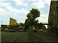
Blue Anchor Lane, SE16
Taken at the corner of St James's Road.
Image: © Danny P Robinson
Taken: 15 Jun 2007
0.05 miles
3
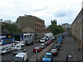
Blue Anchor Lane, Bermondsey
A road with a historic name, this is the quieter northern end.
Image: © Stephen Craven
Taken: 15 May 2014
0.05 miles
4
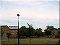
Open space adjacent to Linsey Street
The foreground of this photo is where there was once a terrace of houses as seen in the 1948 view: Image
Image: © Stephen Craven
Taken: 1 Jun 2011
0.05 miles
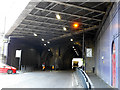
5
Blocked arch under St James Road railway bridge
One of several such blocked arches under the central part of the bridge Image Former use unknown.
Image: © Stephen Craven
Taken: 15 May 2014
0.06 miles
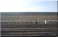
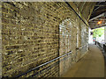
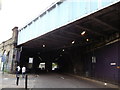
7
St James Road railway bridge, Bermondsey
The central part of the bridge consists of two arches; the two tracks nearest the camera are currently formed by a steel span, but these are part of the original alignment of the London and Greenwich Railway, so would almost certainly have been carried on brick arches originally. See also Image
Image: © Stephen Craven
Taken: 15 May 2014
0.07 miles
8
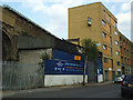
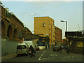
Blue Anchor Garage (closed)
The business had relocated elsewhere; I expect the site would soon be sold for housing development.
Image: © Stephen Craven
Taken: 15 May 2014
0.07 miles
9
Railway bridge over St. James's Road
St. James's Road leads from Jamaica Road towards Southwark Park Road.
The bridge carries the lines leading towards London Bridge (and Cannon Street).
Image: © David Anstiss
Taken: 25 Sep 2011
0.08 miles
10
Linsey Street, 48 years on
This is a recreation of the view in the 1963 photo at http://www.geograph.org.uk/photo/2026569 Image
Only the low wall and metal fence around the grassed area in the foreground gives a fix: everything else has changed. The railway arches in the distance in the earlier photo are now hidden behind later buildings, and the terraced housing on Linsey Street itself has been demolished. Linsey Street is now a dead-end although a stub of it remains beyond the railway viaduct.
Image: © Stephen Craven
Taken: 1 Jun 2011
0.08 miles