1
Towerblock, Brmondsey
Image: © N Chadwick
Taken: 25 Oct 2015
0.03 miles
2
Southwark Park Road, Bermondsey
Image: © David Howard
Taken: 6 Aug 2017
0.07 miles
3
Flats on Southwark Park Road
Image: © David Howard
Taken: 6 Aug 2017
0.08 miles
4
Where do we go Geographing next ?
A group of Geograph contributors (at the junction of Webster Road and Clements Road) on a walk to mark the project's tenth anniversary.
Image: © David Anstiss
Taken: 8 Mar 2015
0.08 miles
5
Former Southwark College, Bermondsey (3)
A view from Clements Road.
Image: © Stephen Craven
Taken: 8 Mar 2015
0.08 miles
6
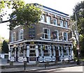
The former New Concord Public House
This pub has been converted into apartments.
It was formerly named after the Concord aircraft and had a pub sign with the plane on it.
See http://spitalfieldslife.com/2014/03/10/antony-cairns-dead-pubs/ for a black and white photo of the pub and pub sign.
Image: © David Anstiss
Taken: 8 Mar 2015
0.09 miles
7
Former Southwark College, Bermondsey (4)
A view from Clements Road.
Image: © Stephen Craven
Taken: 8 Mar 2015
0.09 miles
8
Towerblock, Bermondsey
Image: © N Chadwick
Taken: 14 Jun 2014
0.10 miles
9
Trackside in Bermondsey: the Biscuit Factory
The Biscuit Factory, formerly known as the Tower Bridge Business Complex, is a complex of office and manufacturing units sited in the old Peek Frean biscuit factory, the latter having been a major employer in Bermondsey for decades. The Biscuit Factory houses at least one TV production company and British TV viewers will often see the buildings, streets and railway arches of this area as the backdrop to car chases or police stakeouts.
The graffiti "Fundin' Cuts and Corporate Sluts" is a product of the deficit-dominated atmosphere of 2010. It lasted about a week in this form before work began on covering it up. I'm no great fan of graffiti, to put it mildly, but it seems that there's a definite hierarchy of response: things like this offering political comment are targeted immediately whilst teenagers' idiot tagging can last for years.
Image: © Christopher Hilton
Taken: 14 Dec 2010
0.11 miles
10
The Stanley Arms. 418, Southwark Park Road, Rotherhithe, London, SE16
Is at the junction with Stalham Street (left) and was first recorded in 1866. For many years (1960-1975), like all the pubs in the area, it was a dowdy looking building that sold alcohol. It appears that competition has brightened up such buildings. Original pub on the site was the 'Joiners Arms'.
Image: © Chris Lordan
Taken: 12 Oct 2009
0.11 miles


