IMAGES TAKEN NEAR TO
Linden Grove, LONDON, SE15 3JY
Introduction
This page details the photographs taken nearby to Linden Grove, SE15 3JY by members of the Geograph project.
The Geograph project started in 2005 with the aim of publishing, organising and preserving representative images for every square kilometre of Great Britain, Ireland and the Isle of Man.

There are currently over 7.5m images from over14,400 individuals and you can help contribute to the project by visiting https://www.geograph.org.uk
Image Map
Images are licensed for reuse under creativecommons.org/licenses/by-sa/2.0
Notes
- Clicking on the map will re-center to the selected point.
- The higher the marker number, the further away the image location is from the centre of the postcode.
Image Listing (92 Images Found)
Images are licensed for reuse under creativecommons.org/licenses/by-sa/2.0
Image
Details
Distance
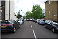
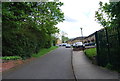
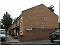
5
Brackley Avenue, Nunhead
Modern close of houses on Linden Grove.
Image: © David Anstiss
Taken: 25 Sep 2011
0.07 miles
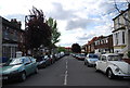
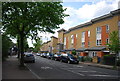
8

Road up, Nunhead Lane, SE15
The A2214.
Image: © Robin Webster
Taken: 30 Oct 2011
0.09 miles
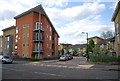
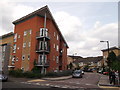
9
Abbotsbury Mews
This site on Nunhead Grove has an interesting history. From 1892 to c.1910 there was the Cheltenham College Mission Church, and later the Royal Pram Company works. The present housing on the site looks quite recent.
Image: © Stephen Craven
Taken: 20 Aug 2008
0.10 miles