1
Williams Terrace, Commercial Way, Peckham
19th century housing on Commercial Way, just off the Old Kent Road.
Image: © Stephen Craven
Taken: 4 Jun 2010
0.00 miles
2
Williams Terrace, Commercial Way, SE15
Williams Terrace on Commercial Way, SE15. At the end of the street is Old Kent Road, the cheapest square on the Monopoly board.
Image: © Malc McDonald
Taken: 27 Jun 2010
0.03 miles
3
Bird-in-Bush Park, Peckham
A small urban park occupying a triangle of land between Bird-in-Bush Road, Naylor Road and Commercial Way. Probably a Second World War bomb site that was never rebuilt.
Image: © Stephen Craven
Taken: 4 Jun 2010
0.04 miles
4
Camelot School: old buildings
The original (1893) school buildings on Bird-in-Bush Road, Peckham. The school is a state primary.
The high-rise building behind is Peterchurch House on the Ledbury Estate.
Image: © Stephen Craven
Taken: 4 Jun 2010
0.05 miles
5
Camelot School: date stone
The date stone on what is now Camelot School reads "LSB Bird-in-Bush Road Schools 1893". LSB was the London School Board - see http://en.wikipedia.org/wiki/London_School_Board for a history.
Image: © Stephen Craven
Taken: 4 Jun 2010
0.05 miles
6
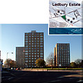
Ledbury Estate SE15
Image: © Philip Talmage
Taken: 18 Nov 2005
0.06 miles
7
The Lodge Caroline Gardens Peckham
This is one of two lodges at the entrances to the estate
Image: © PAUL FARMER
Taken: 31 May 2009
0.06 miles
8
Caroline Gardens lodge
This is one of two lodges at the entrances to Caroline Gardens.
Image: © Martin Speck
Taken: 18 Jun 2016
0.06 miles
9
Caroline Gardens or the Licensed Victuallers Benevolent Institution
Built from 1827 onwards, these were built as the Licensed Victuallers Benevolent Institution. It was a haven for the staff and families who, after a long and loyal service to the brewing industry, went to live out their days in dignity and grace, with the industry often helping them after they fell on hard times.
Ian Nairn in 1966 described these as the most affable of London's many Grecian public buildings. He goes on to say "The scale is huge, but it never overpowers. Instead the big windows and wide stretches of yellow brick radiate serenity and tranquillity. It must be a good place to retire to; and there is a pub just across the road if you feel homesick."
The Licensed Victuallers certainly built on the monumental scale as can be seen at their former school on Kennington Lane http://www.geograph.org.uk/photo/2706512 Further ranges were built in the mid-19th century. By 1960 the brewing industry decided that the complex no longer met their purpose, more because they needed to expand the site further and the scope was not there in the Asylum Road site. They moved to Denham in Buckinghamshire, and sold the buildings to Camberwell Council. The council made the decision to retain the site as residential units, and also decided to change the name from the Licensed Victuallers Asylum to Caroline Gardens, named after a former resident called Caroline Seeker. She was the former wife of a Royal Marine, James Seeker, who was said to be the man who caught Nelson after he was wounded at Trafalgar.
Image: © Marathon
Taken: 16 Nov 2011
0.07 miles
10
Camelot Primary School, SE15
Camelot Primary School, on Bird in Bush Road, SE15.
Image: © Malc McDonald
Taken: 27 Jun 2010
0.07 miles


