1
Ghost Sign for Lipton's Tea
A large old painted advert on an end of terrace wall on the corner of Mornington Road.
"The finest the world produces" it says underneath, which sounds somehow old fashioned as well.
I wonder what happened to the L .
Image: © Des Blenkinsopp
Taken: 6 Mar 2020
0.02 miles
2
A2 New Cross Road
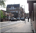
The best way to view this normally very busy road, and certainly the safest way to photograph it, is from the top deck of a bus. On a Sunday afternoon the traffic was light compared to a weekday rush hour but one pedestrian can be seen still having difficulty finding space to cross! The road to the left is Mornington Road.
Image: © Stephen Craven
Taken: 18 Jan 2015
0.03 miles
3
Stanley Street, New Cross
Much of the Deptford/New Cross area has already been redeveloped, but in this back street there are a couple of run-down brick buildings probably dating from the 19th century or earlier.
Image: © Stephen Craven
Taken: 1 Jun 2009
0.05 miles
4
Terraced Housing on New Cross Road
Image: © Des Blenkinsopp
Taken: 6 Mar 2020
0.05 miles
5
Stanley Street School Deptford
Image: © David Lunn
Taken: 30 Sep 2010
0.07 miles
6
New Cross Road (A2), London, SE14
Image: © Stacey Harris
Taken: 29 May 2010
0.08 miles
7
Waldron Health Centre, Amersham Vale
The centre was built for the Lewisham Primary Care Trust, later superseded by NHS South East London http://selondon.nhs.uk/ . Phase 1 of the centre opened in 2007, the second phase was due to be completed in 2008, but due to the recession, by mid-2009 part of it was still an abandoned construction site. For a photo on completion, see
Image For the centre's website, see http://newcrossgpwalkin.co.uk/
Image: © Stephen Craven
Taken: 1 Jun 2009
0.08 miles
8
The Mornington Centre, Stanley Street, New Cross
A local authority education centre. It was the focus of a local media story in April 2009 when children were transferred here from Lewisham Bridge School some distance away, to the anger of parents. http://defendeducationlewisham.wordpress.com/
Geograph member John Webb recalls, "This building was the Upper School when I knew it in 1959-1964 - did my 'O' and 'A' levels here. The lower school was near St John's Station in TQ3776. It had the 'Technical' removed from the name at some point during my stay here - I don't know precisely why!"
Image: © Stephen Craven
Taken: 1 Jun 2009
0.08 miles
9
Royal Albert Public House, Deptford
This pub is on the junction of A2 New Cross Road (on the left) and Florence Road (on the right).
Image: © David Anstiss
Taken: 25 Sep 2011
0.08 miles
10
Tan's cafe, Amersham Vale, Deptford
The cafe is well situated opposite the entrance to New Cross Station.
Image: © Stephen Craven
Taken: 19 Apr 2014
0.08 miles


