IMAGES TAKEN NEAR TO
Pepys Road, LONDON, SE14 5SG
Introduction
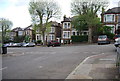
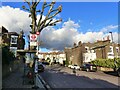
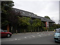
This page details the photographs taken nearby to Pepys Road, SE14 5SG by members of the Geograph project.
The Geograph project started in 2005 with the aim of publishing, organising and preserving representative images for every square kilometre of Great Britain, Ireland and the Isle of Man.

There are currently over 7.5m images from over14,400 individuals and you can help contribute to the project by visiting https://www.geograph.org.uk
Image Map
Images are licensed for reuse under creativecommons.org/licenses/by-sa/2.0
Notes
- Clicking on the map will re-center to the selected point.
- The higher the marker number, the further away the image location is from the centre of the postcode.
Image Listing (83 Images Found)
Images are licensed for reuse under creativecommons.org/licenses/by-sa/2.0
Image
Details
Distance
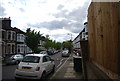
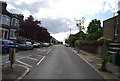
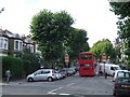
3
Pepys Road, with bus stop and plane tree, Brockley
Image: © Ruth Sharville
Taken: 2 Jan 2023
0.02 miles
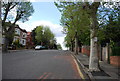
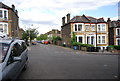
5
Buses Only, Pepys Road near Brockley
To prevent traffic from using this residential road as a short-cut, a "bus only" restriction has been installed on Pepys Road.
Image: © Malc McDonald
Taken: 29 Jun 2011
0.03 miles