IMAGES TAKEN NEAR TO
Lee High Road, LONDON, SE13 5LD

Introduction

This page details the photographs taken nearby to Lee High Road, SE13 5LD by members of the Geograph project.

The Geograph project started in 2005 with the aim of publishing, organising and preserving representative images for every square kilometre of Great Britain, Ireland and the Isle of Man.

There are currently over 7.5m images from over14,400 individuals and you can help contribute to the project by visiting https://www.geograph.org.uk

Image Map


Images are licensed for reuse under creativecommons.org/licenses/by-sa/2.0
Notes
  • Clicking on the map will re-center to the selected point.
  • The higher the marker number, the further away the image location is from the centre of the postcode.

Image Listing (187 Images Found)

Images are licensed for reuse under creativecommons.org/licenses/by-sa/2.0
  • ...
Image
Details
Distance
1
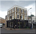
One, Lewisham
Public house on the junction of Belmont Hill (on the left) and Lee High Road (on the left).
Image: © David Anstiss Taken: 25 Sep 2011
0.01 miles
2
One, Lee High Road SE13
At the junction with Belmont Hill
Image: © Robin Sones Taken: 21 Feb 2012
0.01 miles
3
The Lewisham Tavern
On Lee High Road (A20). See Image] for sign.
Image: © JThomas Taken: 24 Jun 2022
0.01 miles
4
Sign for the Lewisham Tavern
See Image] for context.
Image: © JThomas Taken: 24 Jun 2022
0.01 miles
5
White Horse, Lewisham
Image: © Chris Whippet Taken: 1 Mar 2015
0.02 miles
6
Fast food options in Lewisham
At the bottom of Belmont Hill, hungry shoppers can choose from Bucketmouth (English food takeaway), a kebab takeaway or a sit-down cafe.
Image: © Stephen Craven Taken: 1 Mar 2014
0.02 miles
7
Lewis Grove Pharmacy, Lewisham
A long-established business with a distinctive "Mackintosh" style lettering.
Image: © Stephen Craven Taken: 1 Mar 2014
0.02 miles
8
Virgin Media installation, Lewisham
An array of satellite dishes on the roof of a bowling alley. The tall building in the background is "Lewisham House" Image
Image: © Stephen Craven Taken: 13 Jan 2012
0.03 miles
9
Shops on Lee High Road (A20)
Image: © JThomas Taken: 24 Jun 2022
0.03 miles
10
Clarendon Road, SE13
The pale blue cast iron railings mark where the Quaggy River passes under the road - see Image
Image: © Mike Quinn Taken: 30 Jul 2010
0.03 miles
  • ...