IMAGES TAKEN NEAR TO
Dallinger Road, LONDON, SE12 0TL
Introduction
This page details the photographs taken nearby to Dallinger Road, SE12 0TL by members of the Geograph project.
The Geograph project started in 2005 with the aim of publishing, organising and preserving representative images for every square kilometre of Great Britain, Ireland and the Isle of Man.

There are currently over 7.5m images from over14,400 individuals and you can help contribute to the project by visiting https://www.geograph.org.uk
Image Map
Images are licensed for reuse under creativecommons.org/licenses/by-sa/2.0
Notes
- Clicking on the map will re-center to the selected point.
- The higher the marker number, the further away the image location is from the centre of the postcode.
Image Listing (77 Images Found)
Images are licensed for reuse under creativecommons.org/licenses/by-sa/2.0
Image
Details
Distance
1
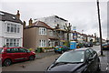
A loft conversion on Dallinger Road
Currently quite a popular home improvement in the London area.
Image: © Bill Boaden
Taken: 11 Oct 2014
0.06 miles
2
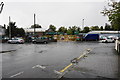
Builders merchant at the end of Dallinger Road
A Travis Perkins site viewed in the rain.
Image: © Bill Boaden
Taken: 11 Oct 2014
0.07 miles
7
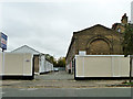
Southbrook Mews
The 'To Let' sign suggests these are light industrial or office units now. There was quite a big yard ringed with buildings to the left originally, without the white buildings in the middle, with a smithy in the corner. Looking very much like accommodation for some of London's many street horses, but nothing was specifically identified on maps, apart from the smithy.
Image: © Robin Webster
Taken: 30 Oct 2011
0.13 miles
8
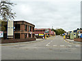
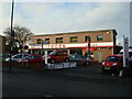
Chiltonian Industrial Estate
Off Manor Lane.
Image: © Robin Webster
Taken: 30 Oct 2011
0.13 miles
9
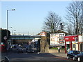
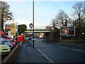
Burnt Ash Hill at Lee Station
The London Underground network does not cover the whole of Greater london. Much of the network is north of the River Thames, and South East London in particular has few Underground lines or stations. On the other hand, the suburban railway network in South and South East London is well developed. Lee station, indicated by the double-arrow sign on the bridge, is one of many suburban railway stations in South East London.
Image: © Malc McDonald
Taken: 19 Mar 2011
0.13 miles
10
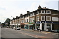
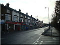
Shops, Burnt Ash Road, Lee
See also Image for a picture of the same location some 46 years earlier.
Image: © Dr Neil Clifton
Taken: 15 Sep 2008
0.14 miles