IMAGES TAKEN NEAR TO
Baring Road, LONDON, SE12 0BE
Introduction
This page details the photographs taken nearby to Baring Road, SE12 0BE by members of the Geograph project.
The Geograph project started in 2005 with the aim of publishing, organising and preserving representative images for every square kilometre of Great Britain, Ireland and the Isle of Man.

There are currently over 7.5m images from over14,400 individuals and you can help contribute to the project by visiting https://www.geograph.org.uk
Image Map
Images are licensed for reuse under creativecommons.org/licenses/by-sa/2.0
Notes
- Clicking on the map will re-center to the selected point.
- The higher the marker number, the further away the image location is from the centre of the postcode.
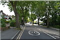
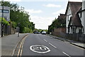
Image Listing (95 Images Found)
Images are licensed for reuse under creativecommons.org/licenses/by-sa/2.0
Image
Details
Distance
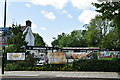
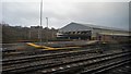
1
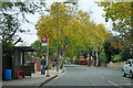
Baring Road, SE12
Baring Road - Coopers Lane bus stop is on the left.
Image: © Robin Webster
Taken: 30 Oct 2011
0.02 miles
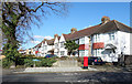
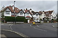
10
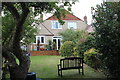
Rear of houses, Burnt Ash Lane, Lewisham
Two semi-detached 1930s suburban houses; there many houses of a similar design in the neighbourhood. In the left foreground is an apple tree.
Image: © M J Roscoe
Taken: 15 Oct 2016
0.14 miles