IMAGES TAKEN NEAR TO
Kennington Lane, LONDON, SE11 4RH
Introduction
This page details the photographs taken nearby to Kennington Lane, SE11 4RH by members of the Geograph project.
The Geograph project started in 2005 with the aim of publishing, organising and preserving representative images for every square kilometre of Great Britain, Ireland and the Isle of Man.

There are currently over 7.5m images from over14,400 individuals and you can help contribute to the project by visiting https://www.geograph.org.uk
Image Map
Images are licensed for reuse under creativecommons.org/licenses/by-sa/2.0
Notes
- Clicking on the map will re-center to the selected point.
- The higher the marker number, the further away the image location is from the centre of the postcode.
Image Listing (217 Images Found)
Images are licensed for reuse under creativecommons.org/licenses/by-sa/2.0
Image
Details
Distance
1
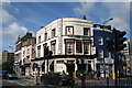
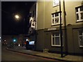
Walworth: 'Toulouse Lautrec' brasserie
Yes, it did used to be a pub
Image: © Dr Neil Clifton
Taken: 23 Jun 2012
0.01 miles
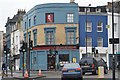
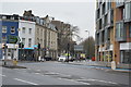
5
Kennington Lane at the corner of Kennington Park Road
Image: © David Howard
Taken: 10 Dec 2013
0.02 miles
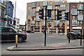
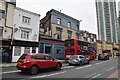
9
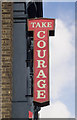
Public house advertising sign, Kennington
The public house has cloeed but the sign remains.
Image: © Jim Osley
Taken: 23 Oct 2016
0.04 miles
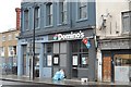
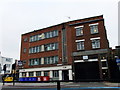
10
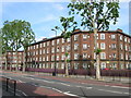
Guinness Trust Buildings, Kennington Park Road, London SE11
Image: © Robin Sones
Taken: 23 Jun 2006
0.04 miles