1
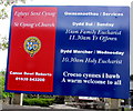
Tŷ Croeso office, Ystradgynlais
This is Tŷ Croeso (Ystradgynlais & District) Ltd's registered office at 25 Heol Eglwys Ystradgynlais. Tŷ Croeso Day Hospice Charity is a support group for cancer sufferers and other local people who have life-threatening diseases.
Image: © Jaggery
Taken: 20 May 2016
0.01 miles
2
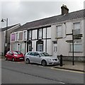
Stone and brick detached house, Ystradgynlais
Heol Eglwys house on the corner of Heol Sant Cynog.
Image: © Jaggery
Taken: 20 May 2016
0.01 miles
3
Information board, St Cynog's Church, Ystradgynlais
Facing Heol Eglwys 100 metres north of the church. http://www.geograph.org.uk/photo/4974062
Image: © Jaggery
Taken: 20 May 2016
0.01 miles
4
Heol Eglwys signpost, Ystradgynlais
On the south side of the B4599 Heol Eglwys, near the corner of Heol Sant Cynog. http://www.geograph.org.uk/photo/4973985
As well as directions to locations within easy walking distance, the signpost shows
cycle route distances to places many miles away, such as Swansea (17) and Neath (13).
Image: © Jaggery
Taken: 20 May 2016
0.02 miles
5
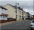
Heol Eglwys Ystradgynlais
Looking NE along the B4599 Heol Eglwys towards the centre of Ystradgynlais.
Image: © Jaggery
Taken: 20 May 2016
0.02 miles
6
Stone structure in Ystradgynlais
The roughly semicircular structure is opposite a car park near the entrance to St Cynog's churchyard. There is nothing on the structure in May 2016 to explain its current or former usage.
Image: © Jaggery
Taken: 20 May 2016
0.02 miles
7
18 Heol Eglwys, Ystradgynlais
In May 2016, the name on the wall of 18 Heol Eglwys is Lola's Cwtch Personalised Welsh Gift.
Image: © Jaggery
Taken: 20 May 2016
0.02 miles
8
Stone lychgate at the entrance to St Cynog's churchyard, Ystradgynlais
From Heol Eglwys. The lychgate is about 100 metres from the church. http://www.geograph.org.uk/photo/4974062
Derived from an old English word for a corpse, a lychgate is the roofed gateway to a churchyard,
formerly used to shelter a coffin until the clergyman's arrival for the burial or pre-burial service.
The information board on the left gives a history of Ystradgynlais in Welsh and English.
Car park information notices are on the right.
Image: © Jaggery
Taken: 20 May 2016
0.03 miles
9
Yew in St Cynog's churchyard, Ystradgynlais
One of several yews in the churchyard, this one is near the entrance from Heol Eglwys.
Image: © Jaggery
Taken: 20 May 2016
0.04 miles
10
Ystradgynlais Post Office
Image: © Darren W Rees
Taken: 26 Jul 2008
0.04 miles


