IMAGES TAKEN NEAR TO
Lloyd George Lane, PEMBROKE, SA71 4EZ
Introduction
This page details the photographs taken nearby to Lloyd George Lane, SA71 4EZ by members of the Geograph project.
The Geograph project started in 2005 with the aim of publishing, organising and preserving representative images for every square kilometre of Great Britain, Ireland and the Isle of Man.

There are currently over 7.5m images from over14,400 individuals and you can help contribute to the project by visiting https://www.geograph.org.uk
Image Map
Images are licensed for reuse under creativecommons.org/licenses/by-sa/2.0
Notes
- Clicking on the map will re-center to the selected point.
- The higher the marker number, the further away the image location is from the centre of the postcode.
Image Listing (38 Images Found)
Images are licensed for reuse under creativecommons.org/licenses/by-sa/2.0
Image
Details
Distance
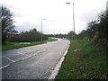
4
Escape lane 200 yards ahead, St Daniel's Hill, Pembroke
The blue sign is at the edge of the long steep descent of the B4319 St Daniel's Hill into Pembroke.
Image: © Jaggery
Taken: 21 Jul 2015
0.12 miles
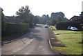
5
Saint Daniel's Hill
On the way to find the GeoCache "Grumpy's Grotto"
Image: © Stephen Bashford
Taken: 27 Nov 2005
0.12 miles
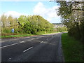
8
Escape lane sign alongside St Daniel's Hill, Pembroke
Alongside a long steep descent into Pembroke, the blue sign shows
that an escape lane (for vehicles with failed brakes) is 400 yards ahead.
Image: © Jaggery
Taken: 21 Jul 2015
0.14 miles
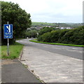
9
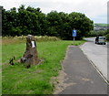
Plaque on a stone alongside St Daniel's Hill, Pembroke
The Highways & Transportation Department plaque on the stone records the B4319 St Daniel's Hill
Improvement Scheme of the early 1990s, a project supported by the Welsh Office's Rural Initiative.
The blue sign http://www.geograph.org.uk/photo/4580731 shows that an escape lane (for vehicles with failed brakes) is 400 yards ahead.
Image: © Jaggery
Taken: 21 Jul 2015
0.14 miles
10
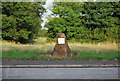
Stone by St Daniel's Hill
A stone to recognise the construction of the road up St Daniel's Hill.
Image: © N Chadwick
Taken: 26 Aug 2013
0.14 miles