1
House on wooded cliff, Saundersfoot
White house overlooking beach; the Centre of Marine excellence is to the right of the woodland.
Image: © M J Roscoe
Taken: 29 May 2022
0.02 miles
2
Saundersfoot - Beach & Apartments
The apartments on the cliff are on Captain's Walk, with fine views over the harbour and beach.
Image: © Peter Whatley
Taken: 19 Jul 2009
0.04 miles
3
St Brides Spa Hotel, Saundersfoot
Viewed from the entrance from the B4316 St Brides Hill above Saundersfoot Bay.
Image: © Jaggery
Taken: 16 Jul 2016
0.04 miles
4
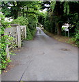
Pen y Graig, Saundersfoot
Pen y Graig is a dead-end lane extending for 85 metres from The Glen near the B4316 junction.
Image: © Jaggery
Taken: 16 Jul 2016
0.04 miles
5
Saundersfoot - looking towards Monkstone
Image: © welshbabe
Taken: 30 Oct 2015
0.06 miles
6
The Glen, Saundersfoot
Image: © Ian S
Taken: 21 Jan 2015
0.06 miles
7
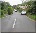
The Glen, Saundersfoot
Road descending from the southeast side of the B4316.
A nearby sign shows that The Glen is part of the Pembrokeshire Coast Path and the Wales Coast Path.
Image: © Jaggery
Taken: 16 Jul 2016
0.06 miles
8
Marine Centre of Excellence, Saundersfoot Harbour
New facility, containing commercial educational and port premises, part of the developing Wales International Coastal Centre at Sundersfoot.
Image: © M J Roscoe
Taken: 29 May 2022
0.06 miles
9
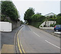
No parking on the B4316 St Brides Hill, Saundersfoot
Double yellow lines on both sides of the road indicate no parking at any time.
Image: © Jaggery
Taken: 16 Jul 2016
0.06 miles
10
B4316 junctions, Saundersfoot
On the east side of the B4316. The Glen http://www.geograph.org.uk/photo/5044744 is on the right, Pen y graig http://www.geograph.org.uk/photo/5044814 on the left.
Image: © Jaggery
Taken: 16 Jul 2016
0.06 miles


