IMAGES TAKEN NEAR TO
Ocean Point, SAUNDERSFOOT, SA69 9LQ
Introduction
This page details the photographs taken nearby to Ocean Point, SA69 9LQ by members of the Geograph project.
The Geograph project started in 2005 with the aim of publishing, organising and preserving representative images for every square kilometre of Great Britain, Ireland and the Isle of Man.

There are currently over 7.5m images from over14,400 individuals and you can help contribute to the project by visiting https://www.geograph.org.uk
Image Map (Loading...)


Getting Data...Please wait
Leaflet Map data © OpenStreetMap
Images are licensed for reuse under creativecommons.org/licenses/by-sa/2.0
Notes
- Clicking on the map will re-center to the selected point.
- The higher the marker number, the further away the image location is from the centre of the postcode.
Image Listing (13 Images Found)
Images are licensed for reuse under creativecommons.org/licenses/by-sa/2.0
Image
Details
Distance
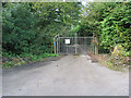
1
Former incline on the Saundersfoot Railway
Looking down.
Image: © David Luther Thomas
Taken: 9 Aug 2006
0.06 miles
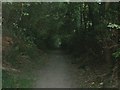
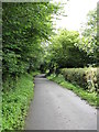
4
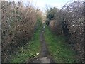
Path heading to Westfield Road
Path from The Ridgeway heading to Westfield Road
Image: © Shaun Ferguson
Taken: 7 Apr 2018
0.08 miles
5
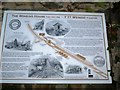
Detail of former incline on the Saundersfoot Railway
The information board displayed on the wall of the winding house.
Image: © David Luther Thomas
Taken: 9 Aug 2006
0.11 miles
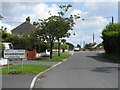
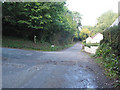
6
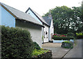
The Incline Cottage
At the junction with Moreton Lane.
Image: © Pauline E
Taken: 28 Sep 2007
0.13 miles
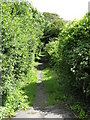
9
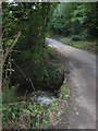
Track To Moreton Farm
A private road at this point, but a public footpath.
Image: © Peter Whatley
Taken: 19 Jul 2009
0.16 miles