Detail of former incline on the Saundersfoot Railway
Introduction
The photograph on this page of Detail of former incline on the Saundersfoot Railway by David Luther Thomas as part of the Geograph project.
The Geograph project started in 2005 with the aim of publishing, organising and preserving representative images for every square kilometre of Great Britain, Ireland and the Isle of Man.

There are currently over 7.5m images from over 14,400 individuals and you can help contribute to the project by visiting https://www.geograph.org.uk
Detail of former incline on the Saundersfoot Railway
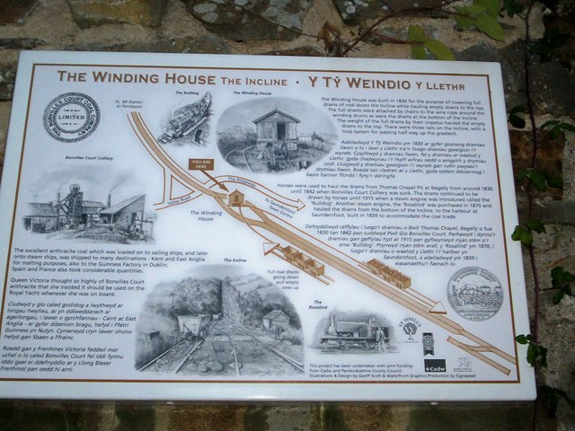
Image: © David Luther Thomas Taken: 9 Aug 2006
The information board displayed on the wall of the winding house.
Images are licensed for reuse under creativecommons.org/licenses/by-sa/2.0
Image Location
Latitude
51.714176
Longitude
-4.712633