1
Entrance to Evening Star Farm, Pentlepoir
From the south side of the A478. A nearby sign shows that Evening Star Farm is a certified Camping Caravanning Club site - members only. Another nearby sign shows Free Horse Manure.
Image: © Jaggery
Taken: 6 Jan 2018
0.02 miles
2
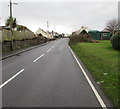
Up the A478, Pentlepoir
The A478 ascends towards the centre of the village. The grassy bank is at the edge of Hill Rise.
Image: © Jaggery
Taken: 6 Jan 2018
0.08 miles
3
Hill Park Caravan Shop, Pentlepoir, Pembrokeshire
Viewed across the A478.
Image: © Jaggery
Taken: 6 Jan 2018
0.09 miles
4
Bend in Hill Rise, Pentlepoir
Hill Rise is a cul-de-sac on the north side of the A478.
Image: © Jaggery
Taken: 6 Jan 2018
0.09 miles
5
Hill Rise electricity substation, Pentlepoir
Located on the right here, https://www.geograph.org.uk/photo/5646502 the green cabinet is a Western Power Distribution electricity substation.
Image: © Jaggery
Taken: 6 Jan 2018
0.10 miles
6
Dragon Palace, Pentlepoir, Pembrokeshire
Chinese Cantonese restaurant on the north side of the A478 opposite Station Road.
Image: © Jaggery
Taken: 6 Jan 2018
0.10 miles
7
Dragon Palace, Pentlepoir, Pembrokeshire
Chinese Cantonese restaurant on the north side of the A478 opposite Station Road.
Image: © Jaggery
Taken: 6 Jan 2018
0.10 miles
8
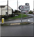
Station Road direction signs, Pentlepoir
The signs facing the A478 show that the B4316 leads to Saundersfoot railway station and Saundersfoot.
An 11' 6" headroom bridge is over the B4316 near the station.
The B4316 is not suitable for heavy goods vehicles - the black and white sign shows another route.
Image: © Jaggery
Taken: 6 Jan 2018
0.11 miles
9
Approaching the A478
Road junction near Pentlepoir.
Image: © Alan Hughes
Taken: 12 Jan 2022
0.12 miles
10
Telecoms cabinets on a Pentlepoir corner
A BT cabinet on the right and a Virgin Media cabinet are on the corner of the A478
and the B4316 Station Road.
Image: © Jaggery
Taken: 6 Jan 2018
0.12 miles


