1
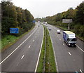
West along the M4 motorway, Morriston, Swansea
Viewed from this footbridge. https://www.geograph.org.uk/photo/5943436 The blue sign shows 2 miles to Swansea West Services, 8 miles to Pont Abraham Services.
Image: © Jaggery
Taken: 16 Oct 2018
0.07 miles
2
Swansea : M4 Motorway
The M4 Motorway heading eastbound through the Swansea area.
Image: © Lewis Clarke
Taken: 11 Apr 2014
0.10 miles
3
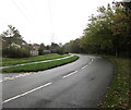
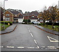
Bend in Heol Maes Eglwys, Morriston, Swansea
The road here is more or less parallel with the M4 motorway out of shot on the right.
Image: © Jaggery
Taken: 16 Oct 2018
0.10 miles
4
Junction of Heol Maes Eglwys and Dan Danino Way, Morriston, Swansea
Viewed across Heol Maes Eglwys in the north of Swansea.
Image: © Jaggery
Taken: 16 Oct 2018
0.11 miles
5
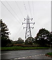
Dominant electricity pylon behind Heol Maes Eglwys, Swansea
Viewed from the corner of Dan Danino Way. The Pant Lasau boundary sign https://www.geograph.org.uk/photo/5943396 is on the far right.
Image: © Jaggery
Taken: 16 Oct 2018
0.11 miles
6
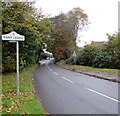
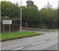
Pant Lasau boundary sign, Swansea
The sign alongside Heol Maes Eglwys faces Morriston.
Pant Lasau is also Pantlasau in English and Pant-lasau in Welsh.
Image: © Jaggery
Taken: 16 Oct 2018
0.11 miles
7
H is for Hospital, Heol Maes Eglwys, Swansea
Faded in October 2018, the sign is on the approach to an entrance to Morriston Hospital.
Image: © Jaggery
Taken: 16 Oct 2018
0.12 miles
8
Dan Danino Way, Morriston, Swansea
From Heol Maes Eglwys in the north of Swansea, Dan Danino Way leads to Gordon Rowley Way.
Image: © Jaggery
Taken: 16 Oct 2018
0.13 miles
9
Morriston Hospital car parks direction sign, Heol Maes Eglwys, Swansea
The black arrow on the sign points left towards Clos George Morgan. https://www.geograph.org.uk/photo/5993227
The text is also in Welsh.
Image: © Jaggery
Taken: 16 Oct 2018
0.13 miles
10
Dan Danino Way
2000s houses in Cwmrhydyceirw.
Image: © Burgess Von Thunen
Taken: 25 Jan 2012
0.14 miles


