1
Haverfordwest Register Office
Viewed across Cherry Grove from Park Road. This building is the location of Pembrokeshire Registration Service which is responsible for the registration of all births, deaths, marriages and civil partnerships which occur in Pembrokeshire.
Image: © Jaggery
Taken: 20 Feb 2019
0.03 miles
2
Steps up from Park Road, Haverfordwest
Ascending to Cherry Grove and The Rise.
Image: © Jaggery
Taken: 20 Feb 2019
0.03 miles
3
Cherry Grove, Haverfordwest
Cherry Grove ascends from Park Road past the Register Office. https://www.geograph.org.uk/photo/6066101
Image: © Jaggery
Taken: 20 Feb 2019
0.03 miles
4
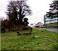
Bench on a grassy bank in Haverfordwest
On the corner of Park Road and Prospect Place.
Image: © Jaggery
Taken: 20 Feb 2019
0.05 miles
5
Prospect Place, Haverfordwest
The small bungalow was demolished in 2007.
Image: © Deborah Tilley
Taken: 24 Dec 2006
0.06 miles
6
Once the Archie B Griffiths Ironmonger Shop
Now falling down.
Image: © Deborah Tilley
Taken: 8 Aug 2008
0.06 miles
7
Bridgend Square, Haverfordwest
The pink building is the Bridgend Inn, known as Bert's Bar. The rundown building to the right was once Archie B Griffiths, Ironmonger. Now falling into serious disrepair. Hill Park Baptist Chapel can just be seen on the left and the Tax Offices at Cherry Grove are on the hill behind.
Image: © Deborah Tilley
Taken: 24 Dec 2006
0.06 miles
8
Park Road telecoms cabinet, Haverfordwest
The dark green cabinet is near a sign pointing left towards the Register Office (Swyddfa Gofrestru in Welsh).
Image: © Jaggery
Taken: 20 Feb 2019
0.06 miles
9
Hill Park Baptist chapel
At the foot of Prendergast Hill. The cream-coloured building, now the vestry, was the original chapel erected in 1858 to serve the Welsh speaking community of Prendergast. In 1888 the larger replacement, side on to the road was built, possibly to house a larger congregation following the end of monolingual services in 1880.
The chapel stands on one of the busy roundabouts of Haverfordwest's deplorable road system.
Image: © Natasha Ceridwen de Chroustchoff
Taken: 21 Jul 2007
0.06 miles
10
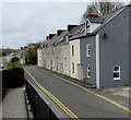
Prospect Place houses, Haverfordwest
Double yellow lines on both sides of the road indicate no parking at any time.
Image: © Jaggery
Taken: 3 May 2018
0.06 miles


