Bridgend Square, Haverfordwest
Introduction
The photograph on this page of Bridgend Square, Haverfordwest by Deborah Tilley as part of the Geograph project.
The Geograph project started in 2005 with the aim of publishing, organising and preserving representative images for every square kilometre of Great Britain, Ireland and the Isle of Man.

There are currently over 7.5m images from over 14,400 individuals and you can help contribute to the project by visiting https://www.geograph.org.uk
Bridgend Square, Haverfordwest
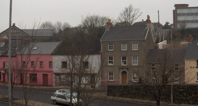
Image: © Deborah Tilley Taken: 24 Dec 2006
The pink building is the Bridgend Inn, known as Bert's Bar. The rundown building to the right was once Archie B Griffiths, Ironmonger. Now falling into serious disrepair. Hill Park Baptist Chapel can just be seen on the left and the Tax Offices at Cherry Grove are on the hill behind.
Images are licensed for reuse under creativecommons.org/licenses/by-sa/2.0
Image Location


Leaflet Map data © OpenStreetMap
Latitude
51.803921
Longitude
-4.966091