IMAGES TAKEN NEAR TO
Mill Bank, HAVERFORDWEST, SA61 2NL
Introduction
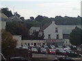
This page details the photographs taken nearby to Mill Bank, SA61 2NL by members of the Geograph project.
The Geograph project started in 2005 with the aim of publishing, organising and preserving representative images for every square kilometre of Great Britain, Ireland and the Isle of Man.

There are currently over 7.5m images from over14,400 individuals and you can help contribute to the project by visiting https://www.geograph.org.uk
Image Map
Images are licensed for reuse under creativecommons.org/licenses/by-sa/2.0
Notes
- Clicking on the map will re-center to the selected point.
- The higher the marker number, the further away the image location is from the centre of the postcode.
Image Listing (629 Images Found)
Images are licensed for reuse under creativecommons.org/licenses/by-sa/2.0
Image
Details
Distance
1
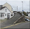
Mill Bank, Haverfordwest
One-way street ascending from Prospect Place towards Cherry Grove.
Image: © Jaggery
Taken: 3 May 2018
0.01 miles
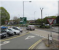
2
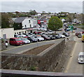
Millbank Motors, Haverfordwest
Car dealers viewed from this http://www.geograph.org.uk/photo/5762799 footbridge.
Image: © Jaggery
Taken: 3 May 2018
0.02 miles
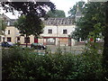
3
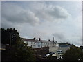
Mill Bank
Overlooking Salutation Square.
Image: © Deborah Tilley
Taken: 10 Sep 2008
0.02 miles
4
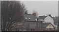
Prospect Place, Haverfordwest
The small bungalow was demolished in 2007.
Image: © Deborah Tilley
Taken: 24 Dec 2006
0.03 miles
5
Mill House (side view)
Now part of a car sales lot.
Image: © Deborah Tilley
Taken: 24 Sep 2008
0.03 miles
6
Junction of Prospect Place and Cartlett Road, Haverfordwest
Give Way signs face Prospect Place. Two CCTV cameras are on top of a pole in the middle of Cartlett Road.
Image: © Jaggery
Taken: 3 May 2018
0.04 miles
7
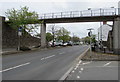
Footbridge over the A487 Cartlett Road, Haverfordwest
Image: © Jaggery
Taken: 3 May 2018
0.04 miles
8
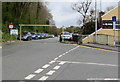
Scotchwell Car Park entrance from Mill Road, Haverfordwest
The metal frame enforces a 6' 6" vehicle height limit.
Image: © Jaggery
Taken: 3 May 2018
0.05 miles
9
Once the Archie B Griffiths Ironmonger Shop
Now falling down.
Image: © Deborah Tilley
Taken: 8 Aug 2008
0.05 miles
10
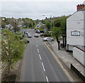
South along Cartlett Road, Haverfordwest
The northbound carriageway of the A487 Cartlett Road viewed from a footbridge. http://www.geograph.org.uk/photo/5762799
The County hotel & restaurant https://www.geograph.org.uk/photo/5767472 is on the right.
Image: © Jaggery
Taken: 3 May 2018
0.05 miles