1
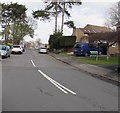
Llys-y-Coed Sheltered Complex, Loughor
Viewed across Glebe Road. Managed by a resident warden,
Llys-y-Coed provides sheltered housing for people aged at least 60.
Image: © Jaggery
Taken: 25 Mar 2016
0.01 miles
2
Mini-roundabout, Glebe Road, Loughor
On the A4240 Glebe Road at the Glanymor Park Drive junction.
Image: © Jaggery
Taken: 25 Mar 2016
0.03 miles
3
Culfor Road, Loughor
Culfor Road heads SE away from the A4240. This junction is where
the A4240 Glebe Road on the left becomes the A4240 Castle Street on the right.
Image: © Jaggery
Taken: 25 Mar 2016
0.03 miles
4
Culfor Road, Loughor
A residential road, but it is a useful cut through towards Gowerton.
Image: © Bill Boaden
Taken: 6 Apr 2016
0.05 miles
5
Glanymor Park Drive, Loughor
On the north side of Glebe Road.
Image: © Jaggery
Taken: 25 Mar 2016
0.06 miles
6
Warning sign - humps to the right and left, Loughor
Showing (speed) hump to the left 120 yds and humps to the right for 350 yds,
the sign faces The Croft at the A4240 Castle Street junction.
Image: © Jaggery
Taken: 25 Mar 2016
0.08 miles
7
Spar shop, Loughor
At 1-3 Castle Street, on the corner of Culfor Road.
Image: © Jaggery
Taken: 25 Mar 2016
0.08 miles
8
Jireh Evangelical Church, Loughor
Alongside a side road north of Castle Street. Opened on April 23rd 1988, this brick building replaced the sixty year old wooden church on the same site. The original building is remembered in the inscription over the doorway
1927 JIREH EVANGELICAL CHURCH 1988.
Image: © Jaggery
Taken: 25 Mar 2016
0.09 miles
9
Side road to Jireh Evangelical Church, Loughor
Parallel with The Croft on the right, this side road north of Castle Street leads to Jireh Evangelical Church. http://www.geograph.org.uk/photo/4922990
Image: © Jaggery
Taken: 25 Mar 2016
0.09 miles
10
Jireh Evangelical church
Evangelical church in Loughor.
Image: © Alan Hughes
Taken: 21 May 2019
0.09 miles


