1
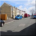
Danybryn Road, Loughor
On the south side of Alexandra Road.
Image: © Jaggery
Taken: 25 Mar 2016
0.08 miles
2
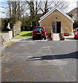
Maesyrhaf Place, Loughor
Dead-end street extending for 100 metres from the east side of Bryn Road.
Image: © Jaggery
Taken: 25 Mar 2016
0.09 miles
3
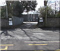
Entrance to the New Lodge, Gorseinon
Entrance only, from the A4240 Alexandra Road. The exit http://www.geograph.org.uk/photo/5001518 is to the east.
Image: © Jaggery
Taken: 25 Mar 2016
0.13 miles
4
Vans in Alexandra Road, Loughor
Chris Farley Carpentry & Construction van and a DPD Global Express Parcels van.
Image: © Jaggery
Taken: 25 Mar 2016
0.13 miles
5
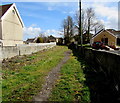
Public footpath towards Danybryn Road, Loughor
From the east side of Bryn Road. Bryn Hall Evangelical Church http://www.geograph.org.uk/photo/5029835 is on the right.
Image: © Jaggery
Taken: 25 Mar 2016
0.14 miles
6
Leisure Launderette, Gorseinon
Launderette at 173 Alexandra Road.
Image: © Jaggery
Taken: 25 Mar 2016
0.14 miles
7
Bryn Hall Evangelical Church, Loughor
Set back 30 metres from the east side of Bryn Road.
Image: © Jaggery
Taken: 25 Mar 2016
0.15 miles
8
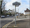
Loughor/Casllwchwr boundary sign
The bilingual (English/Welsh) sign faces the A4240 Alexandra Road in Gorseinon at the eastern boundary of Loughor, a town in the City and County of Swansea, adjacent to Carmarthenshire.
The Gorseinon boundary sign http://www.geograph.org.uk/photo/5001546 is on the back of the Loughor sign.
Image: © Jaggery
Taken: 25 Mar 2016
0.15 miles
9
Western boundary of Gorseinon
The Gorseinon boundary sign is on the corner of the A4240 Alexandra Road and Brynamlwg Road in Loughor. The Loughor boundary sign http://www.geograph.org.uk/photo/5001521 is on the back of the Gorseinon sign.
Image: © Jaggery
Taken: 25 Mar 2016
0.15 miles
10
Ordnance Survey Cut Mark
This OS cut mark can be found on the wall of No132 Alexandra Road. It marks a point 33.165m above mean sea level.
Image: © Adrian Dust
Taken: 15 Jul 2021
0.16 miles


