1
Rhes y Morwyr
Marine Terrace in English, Coastal footpath is at the end of this road.
Image: © chris whitehouse
Taken: 9 Mar 2013
0.00 miles
2
Prospect Place
Looking seaward down Prospect Place, a very short street, the blue building on the right is quite prominent see
Image
Image: © chris whitehouse
Taken: 9 Mar 2013
0.00 miles
3
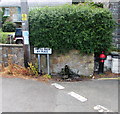
Corner of Marine Terrace and Prospect Place, New Quay
Bilingual street name signs shows that Prospect Place is Golygfor in Welsh and Marine Terrace is Rhes y Morwyr.
Image: © Jaggery
Taken: 4 Jul 2018
0.01 miles
4
Marine Terrace
Looking away from the town, on a crossroads that seems to be called Ivy Place, wonder if there are properties on Ivy Place?
Image: © chris whitehouse
Taken: 9 Mar 2013
0.01 miles
5
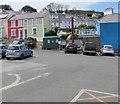
Rock Street Car Park, New Quay
Located between Prospect Place, Wellington Place and High Street, south of Rock Street.
Image: © Jaggery
Taken: 4 Jul 2018
0.01 miles
6
Prospect Place
These buildings on Prospect Place are not shown on the OS maps, Prospect Place is a continuation of Water Street, the sea is to the left, and behind these houses is a large car park with boats parked for the winter, see
Image
Image: © chris whitehouse
Taken: 9 Mar 2013
0.01 miles
7
Western Power Distribution electricity substation at the edge of Rock Street Car Park, New Quay
The dark green cabinet is an electricity substation, identifier NEW QUAY PUMPING STATION S/S 59-6689
Image: © Jaggery
Taken: 4 Jul 2018
0.01 miles
8
Touring caravan with sea views
This touring caravan has been squeezed onto this piece of concrete, but the wheel on the right is in the air, so I presume the caravan is safe, only the far end window looks out onto the sea.
Image: © chris whitehouse
Taken: 9 Mar 2013
0.01 miles
9
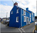
Blue semi-detached houses, Prospect Place, New Quay
The name sign on the wall shows that Golygfor is the Welsh name for Prospect Place.
Image: © Jaggery
Taken: 4 Jul 2018
0.02 miles
10
Old water pillar, Ivy Place, New Quay
One of several old pillars and pumps in New Quay recently painted red and black, viewed in July 2018.
This pillar was rusty and unpainted in an August 2016 Google Earth Street View.
Pistyll Bach, the Welsh name for Ivy Place, means Little Spout.
Image: © Jaggery
Taken: 4 Jul 2018
0.02 miles


