IMAGES TAKEN NEAR TO
/Hilltop Way, CARDIGAN, SA43 2DS
Introduction
This page details the photographs taken nearby to /Hilltop Way, SA43 2DS by members of the Geograph project.
The Geograph project started in 2005 with the aim of publishing, organising and preserving representative images for every square kilometre of Great Britain, Ireland and the Isle of Man.

There are currently over 7.5m images from over14,400 individuals and you can help contribute to the project by visiting https://www.geograph.org.uk
Image Map
Images are licensed for reuse under creativecommons.org/licenses/by-sa/2.0
Notes
- Clicking on the map will re-center to the selected point.
- The higher the marker number, the further away the image location is from the centre of the postcode.
Image Listing (10 Images Found)
Images are licensed for reuse under creativecommons.org/licenses/by-sa/2.0
Image
Details
Distance
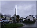
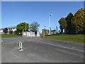
2
Houses opposite the Qinetiq missile base, Aberporth
Overlooking an ex-MOD establishment is hardly the best outlook from the front of these houses.
Image: © Jeremy Bolwell
Taken: 21 Sep 2011
0.17 miles
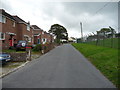
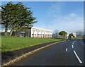
3
Erwlas, Aberporth
A cul-de-sac opposite the old MOD site.
Image: © Jeremy Bolwell
Taken: 26 Jul 2014
0.18 miles
7
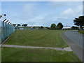
Outside the Qinetiq site
Along the boundary fence of the Qinetiq site above Aberporth.
Image: © Richard Law
Taken: 1 Jun 2011
0.23 miles
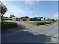
8
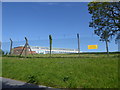
Qinetiq site at Parcllyn, near Aberporth
QinetiQ is a defence, technology and testing group which came into being in 2001 when the Ministry of Defence split the Defence Evaluation and Research Agency into two, with the larger part becoming QinetiQ, which floated in 2006.
Image: © Eirian Evans
Taken: 21 May 2015
0.23 miles
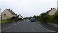
9
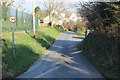
Pennar Road
This minor road carries part of the Wales Coastal Path; the wire fence marks the boundary of the Qinetiq site.
Image: © M J Roscoe
Taken: 24 Feb 2018
0.24 miles
10

Ordnance Survey Rivet
All that remains of this OS rivet is the arrow. It can be found on the low wall south side of the road. It marks a point 90.534m above mean sea level.
Image: © Adrian Dust
Taken: 7 Jun 2021
0.25 miles