1
Lane to the southwest of Peniel, Carmarthenshire
Viewed from Maes Brynglas near these https://www.geograph.org.uk/photo/6286278 National Speed Limit signs. Ahead for Bronwydd.
Image: © Jaggery
Taken: 2 Oct 2019
0.04 miles
2
Adeilad amaethyddol / Agricultural building
Adeilad amaethyddol ym Mheniel.
An agricultural building in Peniel.
Image: © Alan Richards
Taken: 5 Jan 2023
0.06 miles
3
Start of the 30 zone at the western edge of Peniel, Carmarthenshire
The National Speed Limit drops to 30mph on the approach to houses in Maes Brynglas.
Image: © Jaggery
Taken: 2 Oct 2019
0.08 miles
4
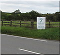
National Speed Limit signs, Maes Brynglas, Peniel, Carmarthenshire
The 30mph speed limit increases to the National Speed Limit beyond the western edge of Peniel.
Image: © Jaggery
Taken: 2 Oct 2019
0.08 miles
5
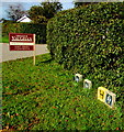
Markers in grass at the edge of a hedge, Maes Brynglas, Peniel, Carmarthenshire
A yellow hydrant marker is between two markers showing SV. The marker on the left shows AV.
Image: © Jaggery
Taken: 2 Oct 2019
0.09 miles
6
No Through Road sign facing Maes Brynglas, Peniel, Carmarthenshire
The road leading to the A485 is a not a through route for motor vehicles.
Image: © Jaggery
Taken: 2 Oct 2019
0.10 miles
7
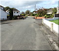
Maes Brynglas houses, Peniel, Carmarthenshire
In an area of modern houses west of the A485, the main road through Peniel.
Image: © Jaggery
Taken: 2 Oct 2019
0.11 miles
8
Road Brynawel
Image: © thejackrustles
Taken: 7 Oct 2022
0.11 miles
9
Y Cam Cynta advert, Peniel, Carmarthenshire
The advert is alongside the A485, the main road through the village
Y Cam Cynta children's day nursery https://www.geograph.org.uk/photo/6286152 is located on a quiet side road opposite the village school.
Image: © Jaggery
Taken: 2 Oct 2019
0.12 miles
10
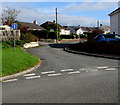
Road towards Maes Brynglas, Peniel, Carmarthenshire
From the west side of the A485, the main road through Peniel.
Image: © Jaggery
Taken: 2 Oct 2019
0.12 miles


