IMAGES TAKEN NEAR TO
Talley, LLANDEILO, SA19 7YG
Introduction
This page details the photographs taken nearby to SA19 7YG by members of the Geograph project.
The Geograph project started in 2005 with the aim of publishing, organising and preserving representative images for every square kilometre of Great Britain, Ireland and the Isle of Man.

There are currently over 7.5m images from over14,400 individuals and you can help contribute to the project by visiting https://www.geograph.org.uk
Image Map
Images are licensed for reuse under creativecommons.org/licenses/by-sa/2.0
Notes
- Clicking on the map will re-center to the selected point.
- The higher the marker number, the further away the image location is from the centre of the postcode.
Image Listing (6 Images Found)
Images are licensed for reuse under creativecommons.org/licenses/by-sa/2.0
Image
Details
Distance
1
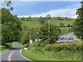
Builders merchant
Supplies store outside Talley.
Image: © Alan Hughes
Taken: 7 Jun 2021
0.01 miles
2
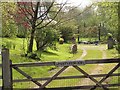
Pant yr Esgair
Gate and driveway into Pant yr Esgair, off the B4302 just outside Talley
Image: © John Atherton
Taken: 27 Apr 2007
0.04 miles
3
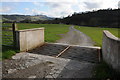
Cattle entrance to Glanyrafonddu-uchaf
Cattle entrance to Glanyrafonddu-uchaf off the B4302 near Talley.
Image: © Philip Halling
Taken: 5 May 2013
0.08 miles

5
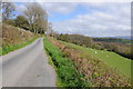
Country road east of Talley
Country road to the east of Talley above the Afon Dulas valley.
Image: © Philip Halling
Taken: 5 May 2013
0.23 miles
6

Ordnance Survey Cut Mark
This OS cut mark can be found on the concrete post at the stile south side of the road. It marks a point 141.384m above mean sea level.
Image: © Adrian Dust
Taken: 9 Jan 2023
0.25 miles