IMAGES TAKEN NEAR TO
Talley Road, LLANDEILO, SA19 7HS
Introduction
This page details the photographs taken nearby to Talley Road, SA19 7HS by members of the Geograph project.
The Geograph project started in 2005 with the aim of publishing, organising and preserving representative images for every square kilometre of Great Britain, Ireland and the Isle of Man.

There are currently over 7.5m images from over14,400 individuals and you can help contribute to the project by visiting https://www.geograph.org.uk
Image Map
Images are licensed for reuse under creativecommons.org/licenses/by-sa/2.0
Notes
- Clicking on the map will re-center to the selected point.
- The higher the marker number, the further away the image location is from the centre of the postcode.
Image Listing (9 Images Found)
Images are licensed for reuse under creativecommons.org/licenses/by-sa/2.0
Image
Details
Distance
1
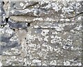
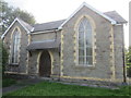
Ordnance Survey Cut Mark
This OS cut mark can be found on the wall of Lasael. It marks a point 41.430m above mean sea level.
Image: © Adrian Dust
Taken: 8 Jun 2021
0.06 miles
2
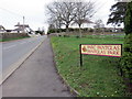
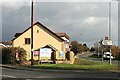
Parc Pantglas / Pantglas Park
Enw ystad Parc Pantglas wrth ochr y B4302.
Pantglas Park (trans. green hollow park), the name of an estate alongside the B4302.
Image: © Alan Richards
Taken: 23 Mar 2019
0.10 miles
3
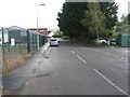
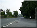
A40 between Llandeilo and Rhosmaen
The A40 leaves Llandeilo through this suburb.
Image: © Derek Harper
Taken: 2 Jan 2015
0.16 miles
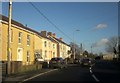
6
New houses
New houses at the junction of the B4302 and the A40 at Llandeilo.
Image: © John Atherton
Taken: 6 Nov 2007
0.18 miles
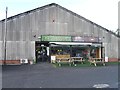
8
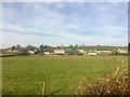
Banc y Berllan Farm
View across fields to Banc y Berllan Farm, Rhosmaen.
Image: © Alan Hughes
Taken: 24 Feb 2019
0.25 miles
9
Roundabout, Llandeilo
Looking towards the roundabout at the intersection of the A483 and A40 roads. The picture was taken from the road junction of the A40 and B4302.
Image: © Martyn Harries
Taken: 5 May 2011
0.25 miles