1
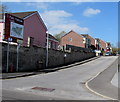
Blaenau Road houses, Llandybie
Viewed across a side road below the B4556 Blaenau Road.
Image: © Jaggery
Taken: 23 Apr 2015
0.04 miles
2
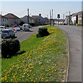
Yellow and green bank in Llandybie
In late April 2015, the yellows in the bank on the side of Blaenau Road are dandelions.
A few weeks earlier, daffodils were the main creators of natural yellow in the village.
Image: © Jaggery
Taken: 23 Apr 2015
0.05 miles
3
Maespiode, Llandybie
Viewed across Blaenau Road. A nearby street name sign shows that Maespiode leads to Glanmarlais.
Image: © Jaggery
Taken: 23 Apr 2015
0.10 miles
4
Woodfield Road, Llandybie
Looking SW from near the Ammanford Road junction. A bilingual sign shows Humps for 100 yards.
Image: © Jaggery
Taken: 23 Apr 2015
0.11 miles
5
Public Memorial Hall, Llandybie
Viewed across Woodfield Road. Dated December 27th 1924, the dedication on the foundation stone is to the memory of the men of Llandybie who fell in the Great War. On the stone, Llandybie is spelt LLANDEBIE. It is highly unlikely that a spelling error would be allowed to remain on such an inscription, so it looks like Llandebie was the prevalent spelling nearly a century ago.
Image: © Jaggery
Taken: 23 Apr 2015
0.15 miles
6
Gosen Chapel,Llandybie
Engraved sign on the wall of Gosen Chapel in Blaenau Road, Llandybie.
Image: © John B R Davies
Taken: 26 Mar 2007
0.16 miles
7
Gosen Chapel, Llandybie
Gosen Chapel in Blaenau Road, Llandybie
Image: © John B R Davies
Taken: 26 Mar 2007
0.16 miles
8
Former Gosen Chapel, Llandybie
Now in residential use, viewed across Blaenau Road in April 2015. This tablet http://www.geograph.org.uk/photo/421245 remains on the building.
Image: © Jaggery
Taken: 23 Apr 2015
0.17 miles
9
Parc Pencae, Llandybie
21st century housing west of Blaenau Road.
Image: © Jaggery
Taken: 23 Apr 2015
0.18 miles
10
Blaenau Road, Llandybie
The B4556 Blaenau Road heads away from the centre of the village.
Image: © Jaggery
Taken: 23 Apr 2015
0.18 miles


