IMAGES TAKEN NEAR TO
Pontardulais Road, AMMANFORD, SA18 3RG
Introduction
This page details the photographs taken nearby to Pontardulais Road, SA18 3RG by members of the Geograph project.
The Geograph project started in 2005 with the aim of publishing, organising and preserving representative images for every square kilometre of Great Britain, Ireland and the Isle of Man.

There are currently over 7.5m images from over14,400 individuals and you can help contribute to the project by visiting https://www.geograph.org.uk
Image Map
Images are licensed for reuse under creativecommons.org/licenses/by-sa/2.0
Notes
- Clicking on the map will re-center to the selected point.
- The higher the marker number, the further away the image location is from the centre of the postcode.
Image Listing (4 Images Found)
Images are licensed for reuse under creativecommons.org/licenses/by-sa/2.0
Image
Details
Distance
1
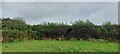
Greynor Trig Point Flush Bracket S2001
Very well hidden in the hedge
Image: © thejackrustles
Taken: 7 Oct 2022
0.14 miles
2
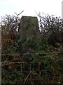
Triangulation Pillar (S2001)
Greynor Triangulation Pillar carries Flush Bracket S2001 which marks a point 151.970m above mean sea level.
Image: © Adrian Dust
Taken: 18 Oct 2007
0.14 miles
3
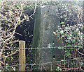
Greynor Trig Point Flush Bracket S2001
Image: © thejackrustles
Taken: 17 Oct 2022
0.15 miles
4

Road junction
The B4297 joins the A483.
Image: © Alan Hughes
Taken: 19 Nov 2018
0.23 miles