IMAGES TAKEN NEAR TO
Clos Y Lloetrach, BURRY PORT, SA16 0TX
Introduction
This page details the photographs taken nearby to Clos Y Lloetrach, SA16 0TX by members of the Geograph project.
The Geograph project started in 2005 with the aim of publishing, organising and preserving representative images for every square kilometre of Great Britain, Ireland and the Isle of Man.

There are currently over 7.5m images from over14,400 individuals and you can help contribute to the project by visiting https://www.geograph.org.uk
Image Map
Images are licensed for reuse under creativecommons.org/licenses/by-sa/2.0
Notes
- Clicking on the map will re-center to the selected point.
- The higher the marker number, the further away the image location is from the centre of the postcode.
Image Listing (63 Images Found)
Images are licensed for reuse under creativecommons.org/licenses/by-sa/2.0
Image
Details
Distance
1
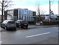
Pembrey School, Pembrey
Primary school viewed across the B4311 Ashburnham Road.
Image: © Jaggery
Taken: 8 Mar 2018
0.04 miles
2
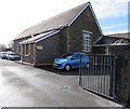
Pembrey Library
Part of the Carmarthenshire County Council library service, Pembrey Library is located in The Old School, Ashburnham Road, Pembrey.
Image: © Jaggery
Taken: 8 Mar 2018
0.06 miles
3
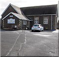
Serendipity Nursery, Pembrey
Children's day nursery in the Old County Primary School, Ashburnham Road.
Image: © Jaggery
Taken: 8 Mar 2018
0.06 miles
4
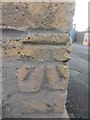
Ordnance Survey Cut Mark
This OS cut mark can be found on the north angle of the school building. It marks a point 9.5585m above mean sea level.
Image: © Adrian Dust
Taken: 2 Feb 2014
0.07 miles
5
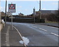
Warning sign - Lle chwarae/Playground, Ashburnham Road, Pembrey
Welsh/English sign on the approach to this https://www.geograph.org.uk/photo/5702692 children's playground.
Image: © Jaggery
Taken: 8 Mar 2018
0.07 miles
7
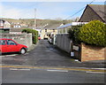
Brooks Lane, Pembrey
Viewed across the B4311 Ashburnham Road.
Image: © Jaggery
Taken: 8 Mar 2018
0.08 miles
8
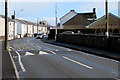
Ashburnham Road speed bumps, Pembrey
Painted white triangles draw attention to the bumps across the B4311 Ashburnham Road.
A children's playground is on the right. https://www.geograph.org.uk/photo/5702692
Image: © Jaggery
Taken: 8 Mar 2018
0.10 miles
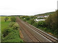
9
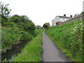
Former canal and railway route in Pembrey
Image: © Gareth James
Taken: 3 Jun 2021
0.10 miles
10
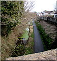
Former railway route, Pembrey
Looking east from the B4311 road bridge. Old maps show a railway here.
Image: © Jaggery
Taken: 8 Mar 2018
0.10 miles