IMAGES TAKEN NEAR TO
Brynhyfryd, BURRY PORT, SA16 0PR
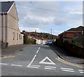
Introduction
This page details the photographs taken nearby to Brynhyfryd, SA16 0PR by members of the Geograph project.
The Geograph project started in 2005 with the aim of publishing, organising and preserving representative images for every square kilometre of Great Britain, Ireland and the Isle of Man.

There are currently over 7.5m images from over14,400 individuals and you can help contribute to the project by visiting https://www.geograph.org.uk
Image Map
Images are licensed for reuse under creativecommons.org/licenses/by-sa/2.0
Notes
- Clicking on the map will re-center to the selected point.
- The higher the marker number, the further away the image location is from the centre of the postcode.
Image Listing (85 Images Found)
Images are licensed for reuse under creativecommons.org/licenses/by-sa/2.0
Image
Details
Distance
1
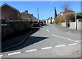
West along The Crescent, Burry Port
The eastern end of The Crescent viewed from the corner of Pencoed Road.
Image: © Jaggery
Taken: 13 Mar 2018
0.04 miles
2
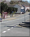
Pencoed Road speed bumps, Burry Port
Painted white triangles draw attention to the bumps. This part of Pencoed Road is one-way for vehicles.
Image: © Jaggery
Taken: 13 Mar 2018
0.06 miles
3
Wires over Pencoed Road, Burry Port
Telephone wires radiate from a pole on the west side of Pencoed Road.
Image: © Jaggery
Taken: 13 Mar 2018
0.06 miles
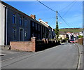
4
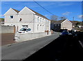
Stepney Road semis, Burry Port
Semi-detached houses set back from the east side of Stepney Road.
Image: © Jaggery
Taken: 16 Mar 2018
0.06 miles
5
East along The Crescent, Burry Port
From Stepney Road along The Crescent towards Brynhyfryd and Pencoed Road.
Image: © Jaggery
Taken: 16 Mar 2018
0.07 miles
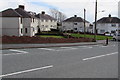
6
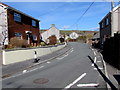
Bend in Pencoed Road, Burry Port
North along Pencoed Road towards Colby Road.
Image: © Jaggery
Taken: 13 Mar 2018
0.08 miles
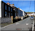
7
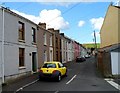
Williams Terrace, Burry Port
Looking north along Williams Terrace from the corner of Pencoed Road.
Image: © Jaggery
Taken: 15 Apr 2012
0.08 miles
8
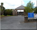
Our Lady Star of the Sea, Burry Port
Set back 30 metres from the north side of Pencoed Road. The church, in the Roman Catholic Diocese of Menevia, was opened by the Bishop of Menevia on August 30th 1964.
Image: © Jaggery
Taken: 15 Apr 2012
0.09 miles
9
Catholic Church this way, Burry Port
The sign on the corner of Colby Road points south along Pencoed Road towards
Our Lady Star of the Sea Catholic Church. https://www.geograph.org.uk/photo/5705631 The sign's text is also in Welsh.
Image: © Jaggery
Taken: 13 Mar 2018
0.09 miles
10
Sunny side of Pencoed Road, Burry Port
Viewed from the shady side on March 13th 2018.
Image: © Jaggery
Taken: 13 Mar 2018
0.09 miles