1
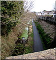
Former canal and railway route in Pembrey
Image: © Gareth James
Taken: 3 Jun 2021
0.04 miles
2
Maes-y-capel houses, Pembrey
Maes-y-capel is a road on the south side of the A484 Gwscwm Road.
Image: © Jaggery
Taken: 16 Mar 2018
0.06 miles
3
Former railway route, Pembrey
Looking east from the B4311 road bridge. Old maps show a railway here.
Image: © Jaggery
Taken: 8 Mar 2018
0.09 miles
4
Queen Elizabeth II postbox and a BT phonebox, Glanaber, Pembrey
Near the corner of Ashburnham Road.
Image: © Jaggery
Taken: 8 Mar 2018
0.09 miles
5
Ashburnham Road speed bumps, Pembrey
Painted white triangles draw attention to the bumps across the B4311 Ashburnham Road.
A children's playground is on the right. https://www.geograph.org.uk/photo/5702692
Image: © Jaggery
Taken: 8 Mar 2018
0.09 miles
6
Children's swings, Pembrey
On the south side of Ashburnham Road.
Image: © Jaggery
Taken: 8 Mar 2018
0.10 miles
7
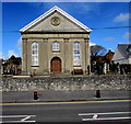
South side of Bethel Church, Pembrey
Viewed across the A484 Gwscwm Road. The year 1876 is inscribed in the roundel.
See https://www.geograph.org.uk/photo/5709342 for a corner view of Bethel and some details.
Image: © Jaggery
Taken: 16 Mar 2018
0.10 miles
8
Southeast side of Bethel Church, Pembrey
Viewed across the A484 Gwscwm Road. The corner of Mountain Road is on the left.
The building is the 1876 rebuild of the 1812 original which was enlarged in 1850.
In March 2018 the nameboard https://www.geograph.org.uk/photo/5709476 shows Eglwys Bresbyteraidd Cymru Bethel Penbre,
Welsh for Bethel Presbyterian Church of Wales Pembrey.
Image: © Jaggery
Taken: 16 Mar 2018
0.10 miles
9
Gwscwm Road houses, Pembrey
Set back from the north side of the A484 here named Gwscwm Road.
Image: © Jaggery
Taken: 16 Mar 2018
0.10 miles
10
Bethel Church nameboard, Pembrey
On the left here. https://www.geograph.org.uk/photo/5709342 Eglwys Bresbyteraidd Cymru Bethel Penbre
is Welsh for Bethel Presbyterian Church of Wales Pembrey.
In March 2018 the board shows that Sunday Service here is in Welsh at 2pm.
Image: © Jaggery
Taken: 16 Mar 2018
0.10 miles


