1
Llwyn Close, Llanelli
Llwyn Close is a cul-de-sac on the NW side of Coed Cae Road.
Image: © Jaggery
Taken: 10 Mar 2016
0.02 miles
2
Coed Cae Road houses, Llanelli
On the north side of the Y Llwyn junction.
Image: © Jaggery
Taken: 10 Mar 2016
0.04 miles
3
Southern end of an A484 footbridge, Llanelli
The footbridge gives walkers and cyclists access between the two halves of Coed Cae Road, severed by the construction of the current route of the A484. The earlier route of the A484 in Llanelli is now the B4297.
Image: © Jaggery
Taken: 10 Mar 2016
0.05 miles
4
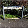
Llwyncyfarthwch name sign, Llanelli
Located here. http://www.geograph.org.uk/photo/5262326
In Llanelli, some name signs are in English only, some in Welsh only.
Many are bilingual. This Welsh-only sign ought to be bilingual,
for the benefit of those who don't speak Welsh....
Image: © Jaggery
Taken: 10 Mar 2016
0.05 miles
5
Coed Cae Uchaf, Llanelli
Cul-de-sac on the northwest side of Coed Cae Road.
Image: © Jaggery
Taken: 10 Mar 2016
0.05 miles
6
Y Llwyn towards Coed Cae Road, Llanelli
Looking NW along the cul-de-sac named Y Llwyn towards Coed Cae Road.
A short side arm of Y Llwyn is on the left. http://www.geograph.org.uk/photo/5262290
Image: © Jaggery
Taken: 10 Mar 2016
0.06 miles
7
Across an A484 footbridge, Llanelli
The footbridge gives walkers and cyclists access between the two halves of Coed Cae Road, severed by the construction of the current route of the A484. The earlier route of the A484 in Llanelli is now the B4297.
Image: © Jaggery
Taken: 10 Mar 2016
0.07 miles
8
Llwybr Heol Coed Cae / Coed Cae Road Path
Llwybr cyhoeddus yn mynd i gyfeiriad Heol Coed Coed. Mae'r ffens yn ffinio a meysydd chwarae Ysgol Gyfyn Coed Cae.
A public footpath heading in the direction of Coed Cae Road with the perimeter fence of Coed Cae Comprehensive School on the right.
Image: © Alan Richards
Taken: 30 Jan 2018
0.08 miles
9
Y Llwyn bungalows, Llanelli
Y Llwyn is a cul-de-sac on the east side of Coed Cae Road.
Image: © Jaggery
Taken: 10 Mar 2016
0.08 miles
10
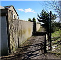
Path from Penywarc Road towards Coed Cae Road, Llanelli
The perimeter fence of the Ysgol Coedcae (Coedcae School) site is on the right.
Image: © Jaggery
Taken: 10 Mar 2016
0.08 miles


